Use APKPure App
Get Topo GPS old version APK for Android
프랑스의 지형도와 직관적 인 야외 GPS 네비게이션
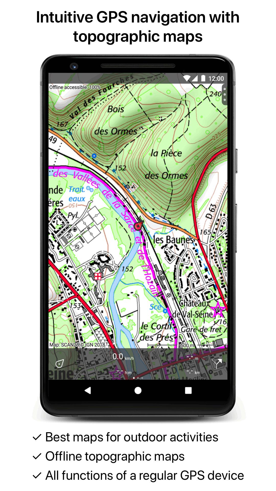
Makes from your phone or tablet a complete GPS device with the detailed topographic map of France. Viewed maps will be stored on your device so that Topo GPS can also be used without an internet connection.
Why should you buy an expensive GPS device if you can install Topo GPS? Topo GPS contains all functions of a regular GPS device for less money, has a much more detailed map, and is more convenient to operate. The accuracy of the position determination is in favorable conditions about 5 m.
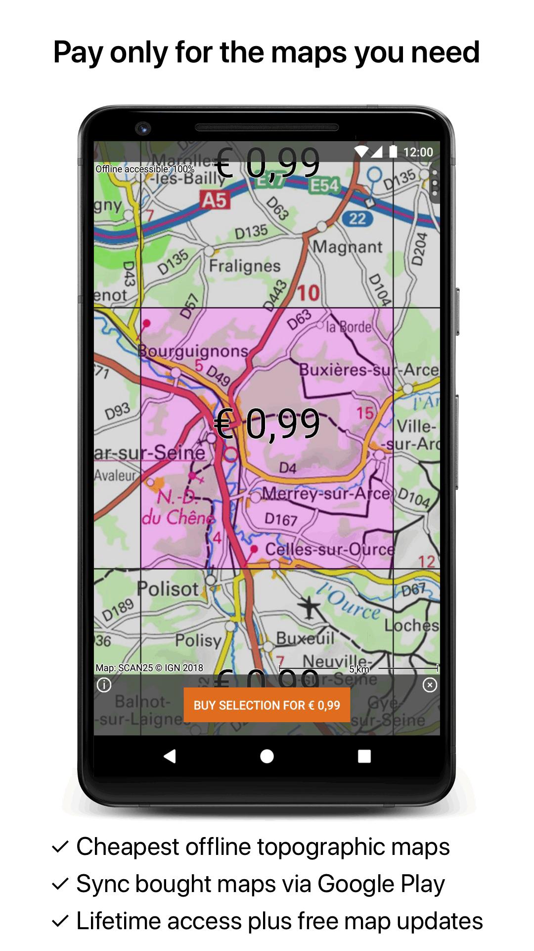
The price of the detailed topographic map is 0,99 € for four sections of 4 by 4 km. You get lifetime access to purchased sections including future map updates. You can easily select the sections you need on an overview map. You get a discount if you buy a large section at once.
Purchases are made available on all devices that share the same Google Play account.
Ideal for walking, hiking, cycling, mountainbiking, horse-riding, geocaching, trail running and other outdoor activities. Also suited for outdoor professionals.
Map
* Complete topographic map of France, scale 1:25,000 (SCAN25 from IGN), newest edition.
* Very detailed maps, with buildings, cultivation, all roads including the smallest forest trails, contour lines, and characteristic elements in the landscape.
* Future updates of the map are included for free.
* The map can be zoomed and moved.
* All maps of a certain region can be made offline accessible using the map download screen.
* Percentage of map that is offline accessible is indicated on the top left of the map.
* Map tiles can be stored on external storage, like for example an SD-card.
Intuitive interface
* Clear menu with most important functions.
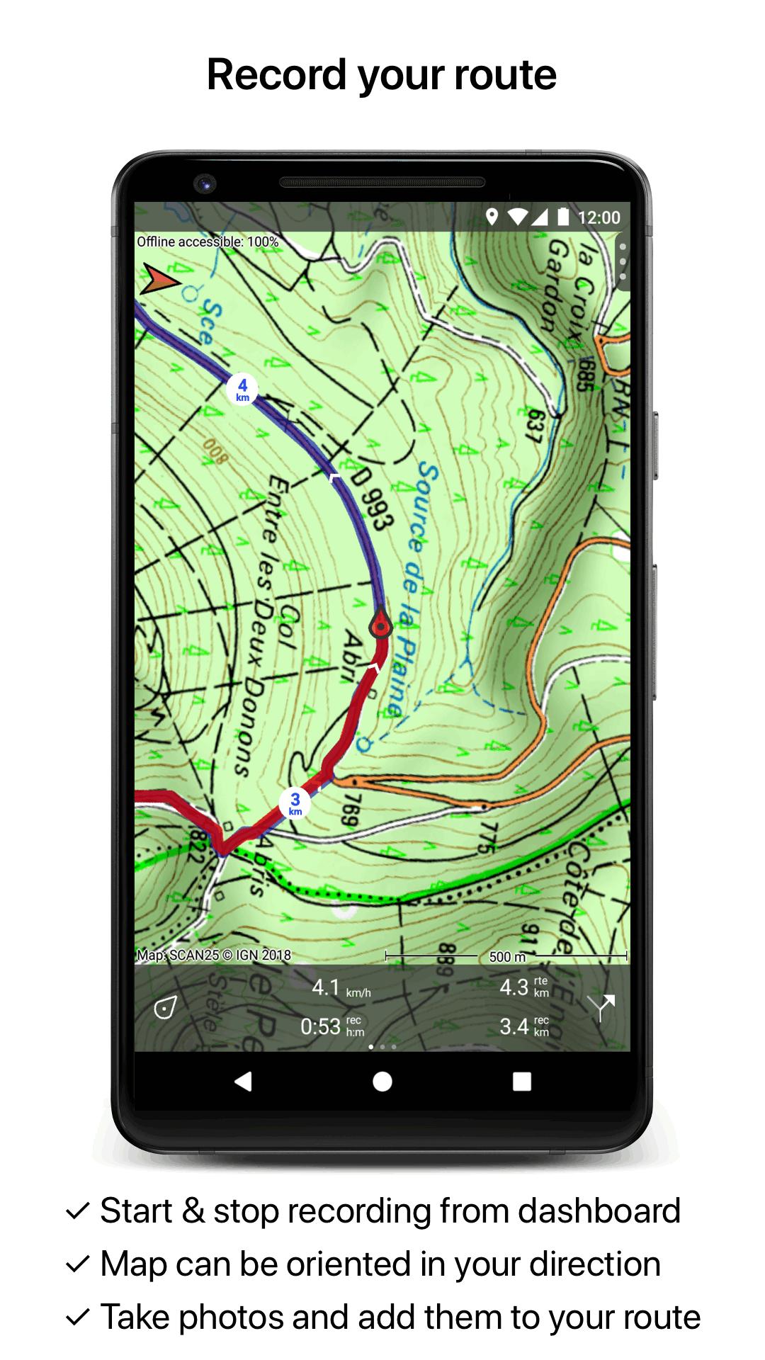
* Different dashboard panels with distance, time, speed, altitude and coordinates.
* Clear manual at www.topo-gps.com.
Routes
* Recording of routes, with pause and restart possibility.
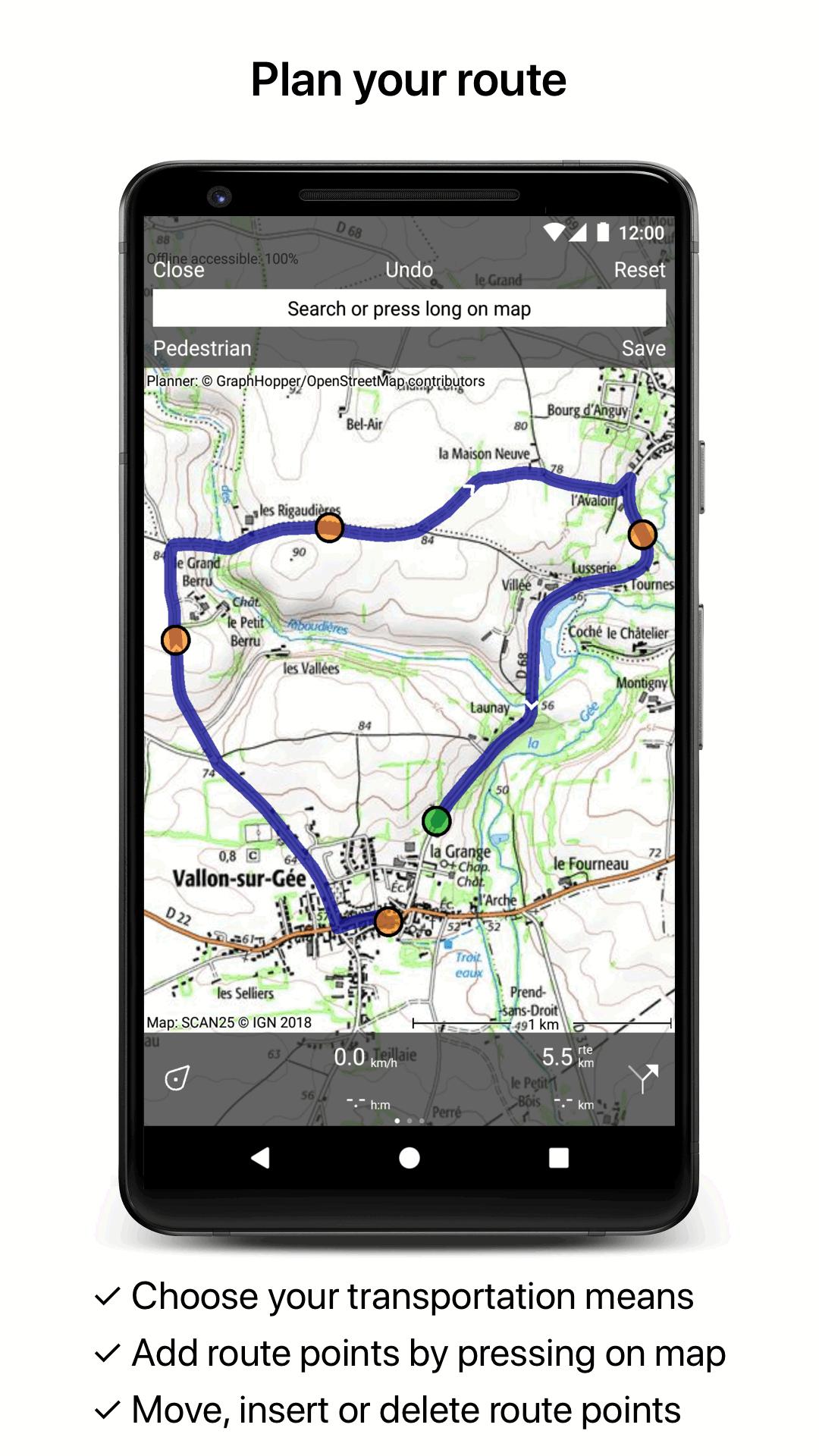
* Planning of routes via route points.
* Importing routes in gpx and zipped gpx format.
* Editing routes.
* Sharing routes.
* Free access to route collection Topo GPS.
* Searching routes with filters.
* Routes can be organized into folders.
* Maps of a route can be made offline accessible.
Waypoints
* Adding waypoints by pressing on map.
* Adding waypoints through address or coordinates.
* Supported coordinate systems: WGS84 decimal, WGS84 degree minutes (seconds), UTM, MGRS and Lambert93.
* Importing waypoints in gpx and zipped gpx format.
* Sharing waypoints.
* Editing waypoints.
* Photos can be added to waypoints.
* Searching waypoints with filters.
* Waypoints can be organized into folders.
Your location
* Location and movement direction indicated by arrowed marker.
* Displayable in WGS84 decimal, WGS84 degree minutes (seconds), UTM, MGRS and Lambert 93 coordinates.
* Sharing and saving as waypoint.
In app purchases
* Topographic maps of Belgium, Denmark, Finland, France, Germany, Great Britain, Netherlands, Norway, New Zealand and Sweden.
* OpenStreetMap world map.
If you are recording a route, the GPS will run in the background. Continued use of GPS running in the background can dramatically decrease battery life.
Rdzl, the company behind Topo GPS, does not obtain in any way the location of the user of Topo GPS. Rdzl does not obtain your routes and waypoints, unless you share a route with Topo GPS. Rdzl does not register which map tiles you have downloaded. We sell our product, not our user data.
Last updated on Mar 7, 2022
- Dark mode maps
- Importing jpeg photo's with location data


Discover what you want easier, faster and safer.

Topo GPS France
7.2.0 by rdzl
Mar 7, 2022