APKPure Appを使用する
Dark Sky Mapの旧いバージョンをダウンロードすることが可能
天体と天体写真のために最小限の光害のある地域を探します
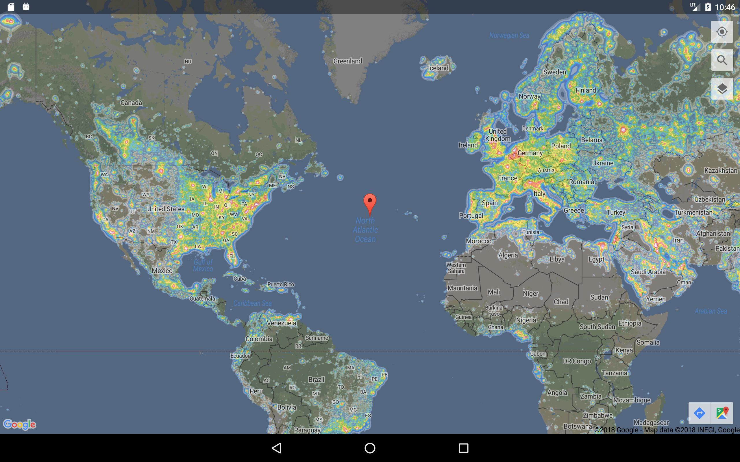
Dark Sky Maps provides an easy to use tool that overlays light pollution data onto the familiar Google Maps interface.
Quickly find areas near you or anywhere in the world with low enough light pollution to view the Milky Way. As a rough guide, look for areas lighter than yellow for the winter Milky Way and lighter than orange for the summer Milky Way.
Permissions:
Location - Allows Google Maps to provide the Locate Me button
Light pollution layers are modified from the public data published with the paper "The new world atlas of artificial night sky brightness". The work uses recently available data from the Suomi NPP satellite.
Paper:
http://advances.sciencemag.org/content/2/6/e1600377.full
Data Citation:
Falchi, Fabio; Cinzano, Pierantonio; Duriscoe, Dan; Kyba, Christopher C. M.; Elvidge, Christopher D.; Baugh, Kimberly; Portnov, Boris; Rybnikova, Nataliya A.; Furgoni, Riccardo (2016): Supplement to: The New World Atlas of Artificial Night Sky Brightness. GFZ Data Services. http://doi.org/10.5880/GFZ.1.4.2016.001
Keywords:
night sky, light pollution, artificial light, skyglow
Last updated on 2018年11月02日
Fixes crash on Android P (9.0)


Discover what you want easier, faster and safer.

Dark Sky Map
2.0.3 by graebr
2018年11月02日