



دربارهی Dark Sky Map
Find areas with minimal light pollution for stargazing and astrophotography
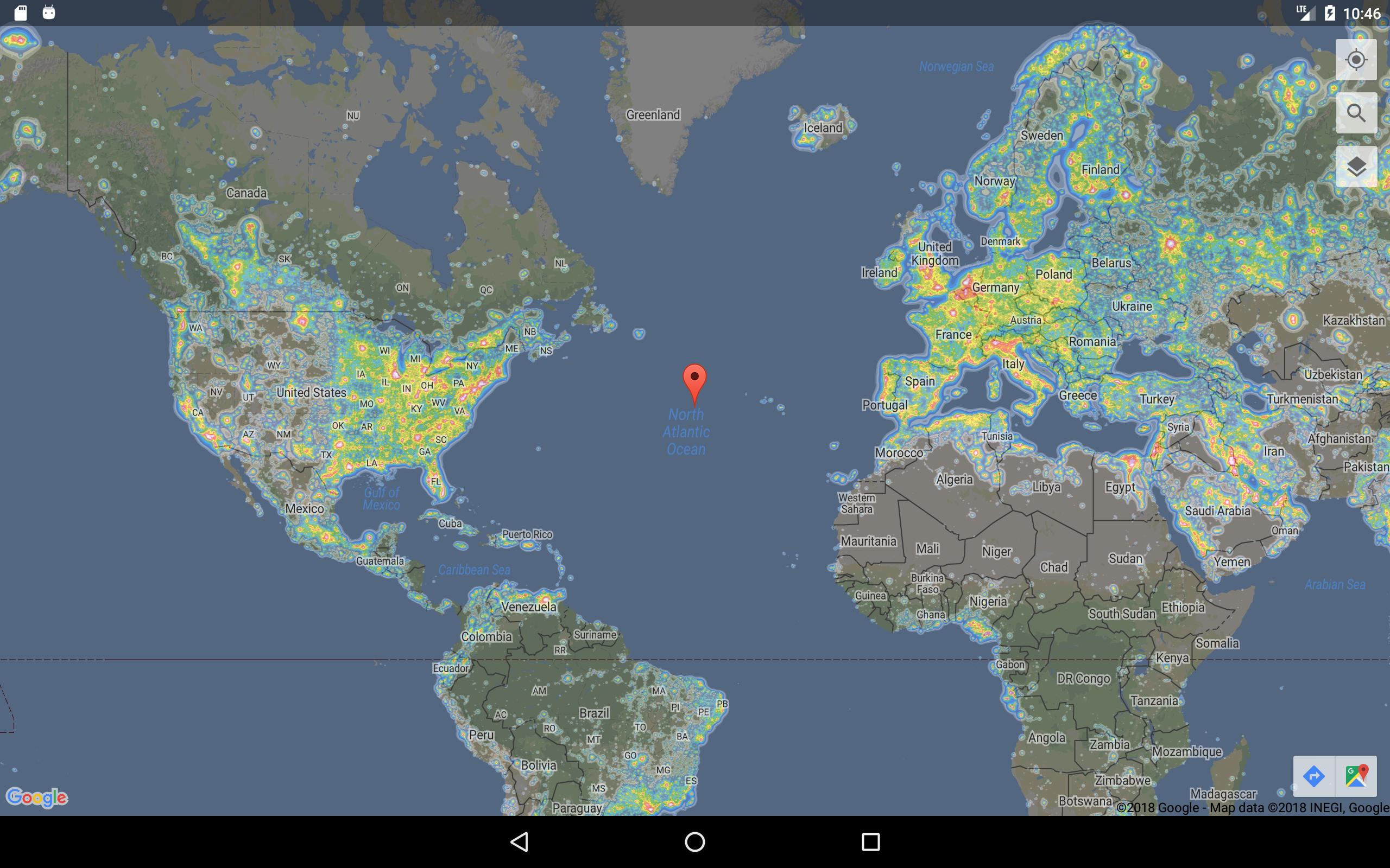
Dark Sky Maps provides an easy to use tool that overlays light pollution data onto the familiar Google Maps interface.
Quickly find areas near you or anywhere in the world with low enough light pollution to view the Milky Way. As a rough guide, look for areas lighter than yellow for the winter Milky Way and lighter than orange for the summer Milky Way.
Permissions:
Location - Allows Google Maps to provide the Locate Me button
Light pollution layers are modified from the public data published with the paper "The new world atlas of artificial night sky brightness". The work uses recently available data from the Suomi NPP satellite.
Paper:
http://advances.sciencemag.org/content/2/6/e1600377.full
Data Citation:
Falchi, Fabio; Cinzano, Pierantonio; Duriscoe, Dan; Kyba, Christopher C. M.; Elvidge, Christopher D.; Baugh, Kimberly; Portnov, Boris; Rybnikova, Nataliya A.; Furgoni, Riccardo (2016): Supplement to: The New World Atlas of Artificial Night Sky Brightness. GFZ Data Services. http://doi.org/10.5880/GFZ.1.4.2016.001
اطلاعات تکمیلی برنامه
آخرین نسخه
2.0.3بارگذاری شده توسط
Tegar Affandi
نیاز به اندروید
Android 6.0+
دسته بندی
رایگان برنامه نقشهها و مسیریابیرتبهبندی محتوا
Everyone
گزارش
گزارش محتوای نامناسبجدیدترین چیست در نسخهی 2.0.3
Last updated on 02/11/2018
Fixes crash on Android P (9.0)
Dark Sky Map اسکرین شات ها




نسخههای قدیمی Dark Sky Map
تمام نسخهها
برچسب های مرتبط












برای Dark Sky Map نظر بدهید
افزودن نظرات