از برنامه APKPure استفاده کنید
نسخه قدیمی APK Wisconsin Waterways را برای اندروید بگیرید
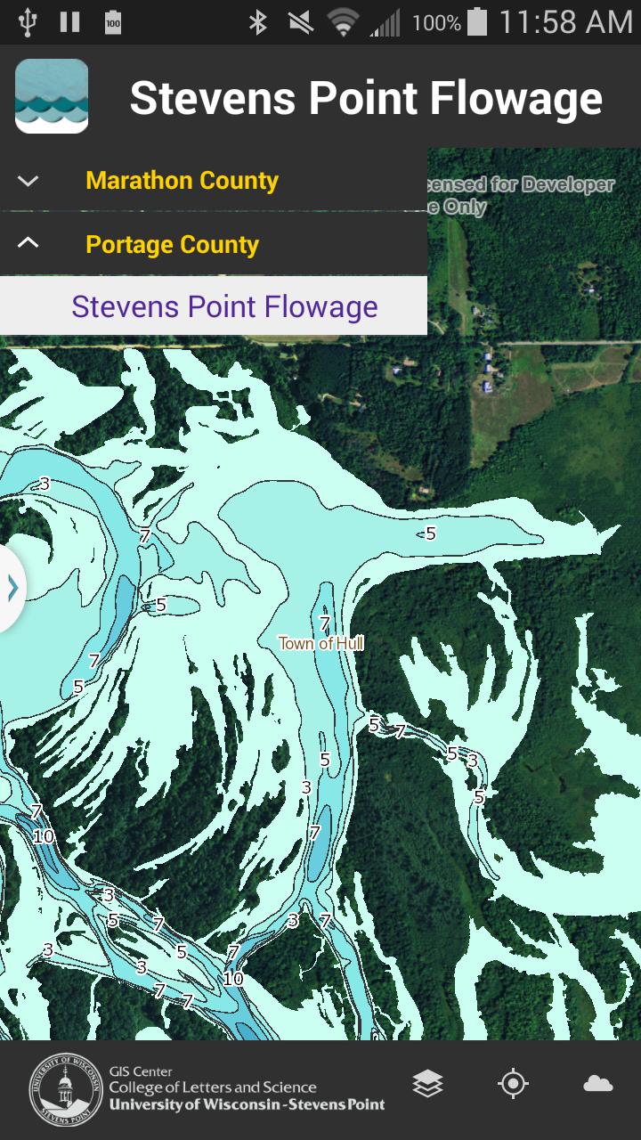
Water depth maps for Central Wisconsin waterways (Portage & Marathon counties).
The Wisconsin Waterways app shows depth contours (in feet) and map information for several Central Wisconsin water bodies including the Stevens Point Flowage (Portage County), Lake Wausau (Marathon County), and eleven Eastern Marathon County Lakes. In addition to water depth contour information under normal water-level conditions, the app also includes the locations of old log pilings (Stevens Point flowage only), points of interest such as nearby parks and boat launch locations, and municipal boundaries. Each map layer can be added or removed to suit user needs.
Features:
• Select from multiple water bodies
• Add/remove map layers
• Geo-location
• Picture taking
• Current and predicted weather reports
Last updated on 17/10/2015
Fixed licensing
آخرین نسخه
![]() 1.0.1
1.0.1
بارگذاری شده توسط
Harun Harki
نیاز به اندروید
Android 4.0+
دسته بندی
گزارش


بیشتر بیابید آنچه که می خواهید آسان تر، سریع تر و ایمن تر است.

Wisconsin Waterways
1.0.1 by University of Wisconsin - Stevens Point+
17/10/2015