Use APKPure App
Get World atlas & world map MxGeo old version APK for Android
World Atlas and educational app for geography. Maps, flags and country data.
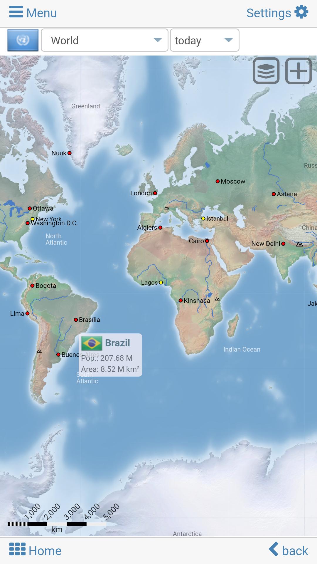
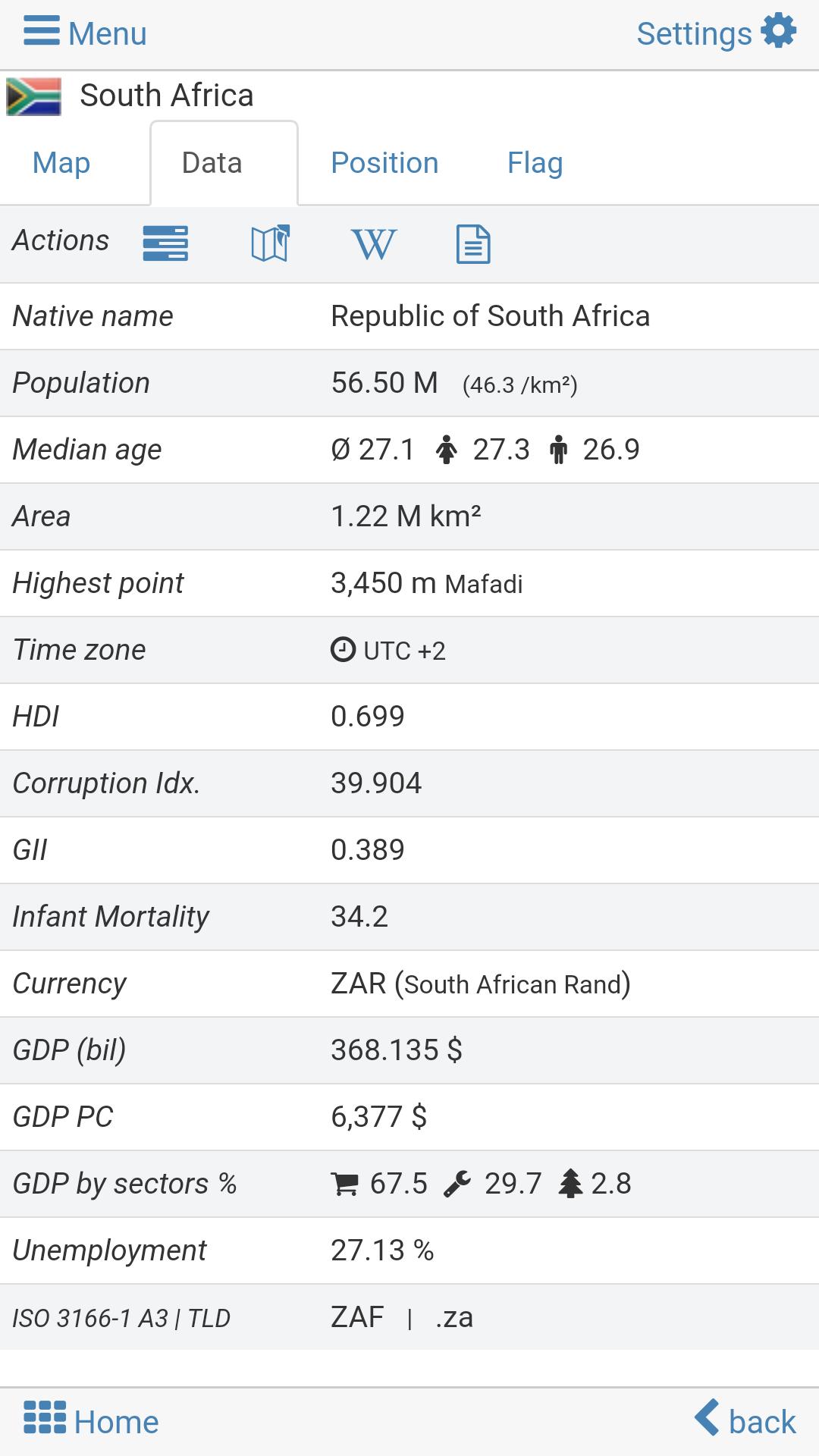
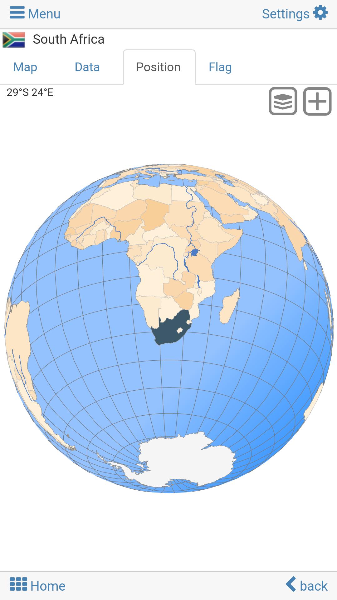
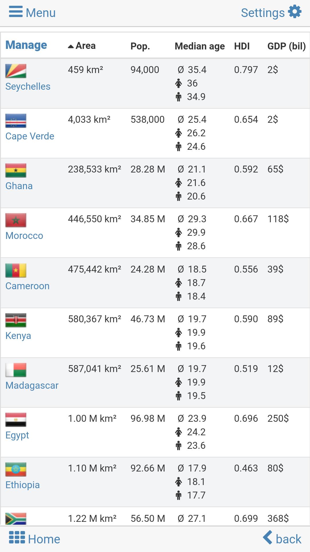
World atlas, world map and educational app for geography. Flags, position maps and basic data about 260 countries and territories of the world. Political maps with regional units and comprehensive economic and statistical country data for all African countries.
Designed for smartphones and tablets.
• Flags, essential maps and basic data for more than 250 countries and territories of the world
• Search for countries, major cities, rivers, mountains, lakes or coordinates
• Interactive political world and continent maps
• Shaded relief layer for world and continent maps
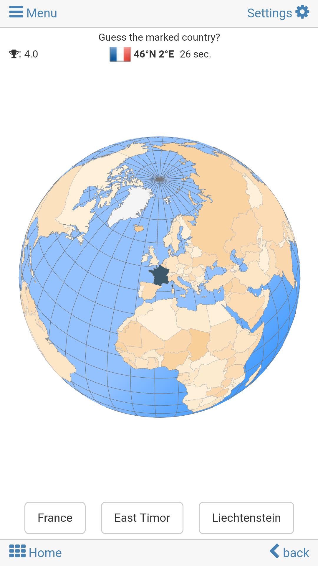
• Geography quiz challenge for playful learning
• Country comparison, favorites and distance calculator
• Comprehensive maps and data of all African countries
• Choropleth maps: area and population
• World clock and distance calculator
• World-explorer: the smallest, largest, ... countries
• No online connection required
Explore the world by political world and continent maps offline maps. Learn where each country in the world is located. View its position highlighted on a digital globe. Create your favorite color theme or choose from different color schemes for map display.
Do you know the flag of Zambia? Yes? Perfect. Do you also know in which country Mount Kilimanjaro is located? “World atlas & world map MxGeo Free” Quiz helps you acquire a geographic literacy in a playful manner.
Choose from six geo guessing games:
• Test your knowledge about the capitals of Africa
• Do you know the ISO countries codes?
• Recognize the proper country flag based on the outline map
• Do you know the top-level domains of each country?
• Guess the highlighted country on the virtual globe
• Do you know the mountains of Africa?
Geo learning app and educational game which is fun for everyone whether children, adults, seniors or teachers. Get ready for your next stay abroad while enjoying this great world almanac including time zones and statistical data, such as population growth and other key figures. Or prepare for your next geography lesson with this genius digital world map. If not traveling our world atlas lets you explore the world just only virtually.
Free version includes comprehensive data and maps for all African countries. Get “World atlas & world map MxGeo Pro” with detailed data and maps including regional units and capitals for more than 260 countries and territories of the world: Europe, Asia, North America, Africa, Oceania and South America.
Last updated on Jan 9, 2024
• Updates for maps and data
• Bug fixes and improvements
8.x:
• Improved quiz questions choice
• Country comparison and World Explorer new key indicator: population density
• New choropleth map: population density
• Search for countries, major cities, rivers, mountains, lakes and coordinates
• World Explorer: largest cities, longest rivers and highest mountains
Latest Version
![]() 9.1.2
9.1.2
Uploaded by
Fatih Göksu
Requires Android
Android 7.0+
Available on
![]()
Category
Report


Discover what you want easier, faster and safer.
