下載 APKPure App
可在安卓獲取OwlsheadGPS Project的歷史版本
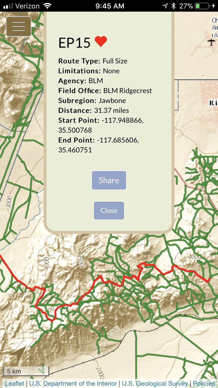
該OwlsheadGPS應用程序包括37000多OHV和其他機動路線。
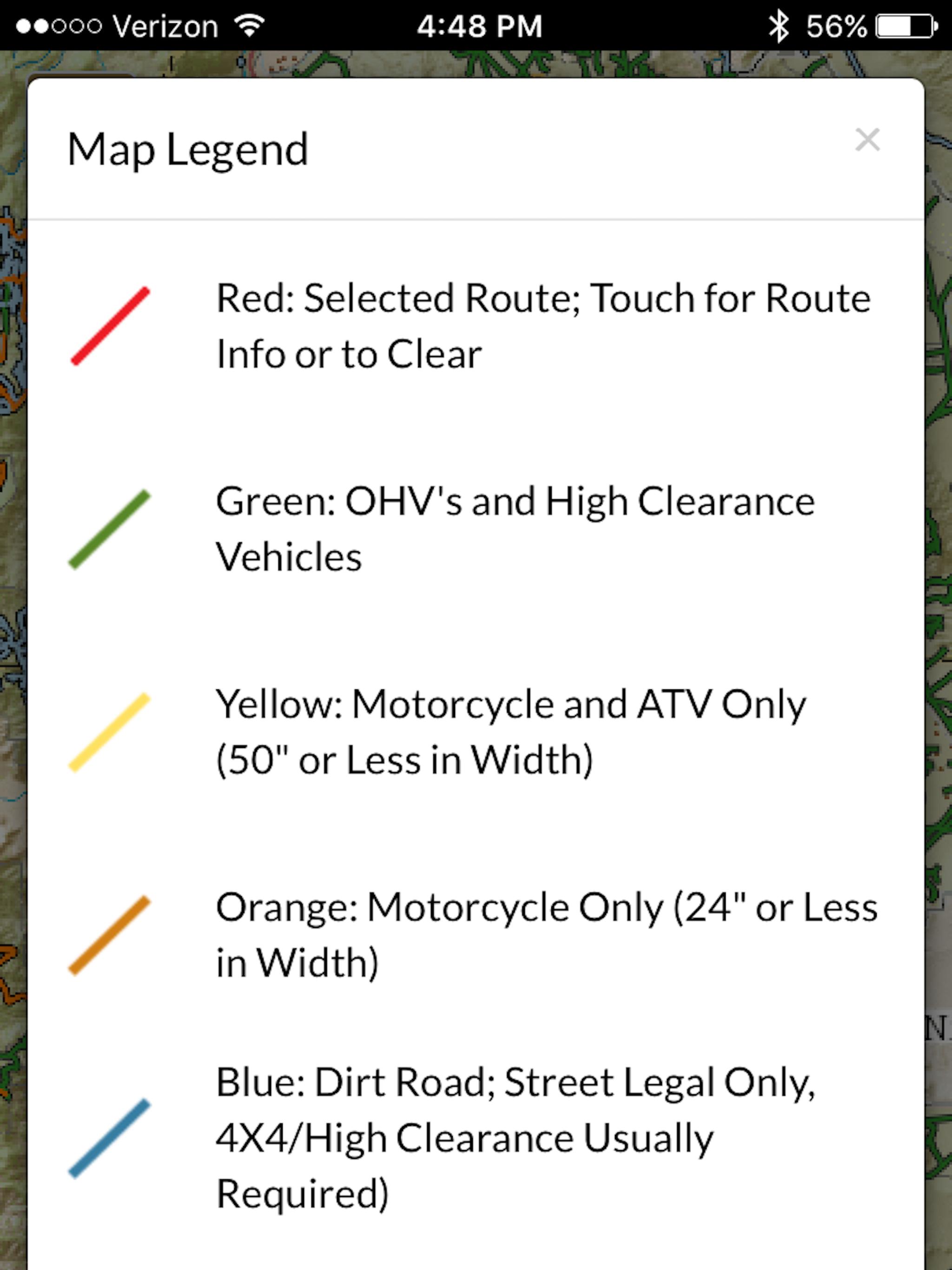
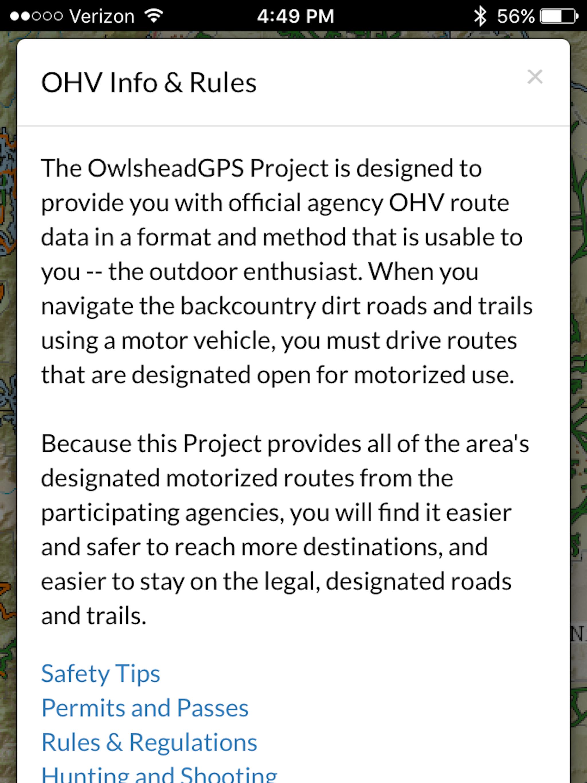
The OwlsheadGPS OHV Trails app depicts the designated OHV route networks of participating pubic land management agencies in California. We’ve acquired their official OHV route data and combined them into a mobile app that is designed for you -- the outdoor enthusiast. Remember, when you navigate California's backcountry dirt roads and trails using your motor vehicle, you must only drive on the routes that are officially designated and signed open for motorized use. Other OHV apps feature route data supplied by users and non-agency sources and may depict routes that are not actually legal for motorized use.
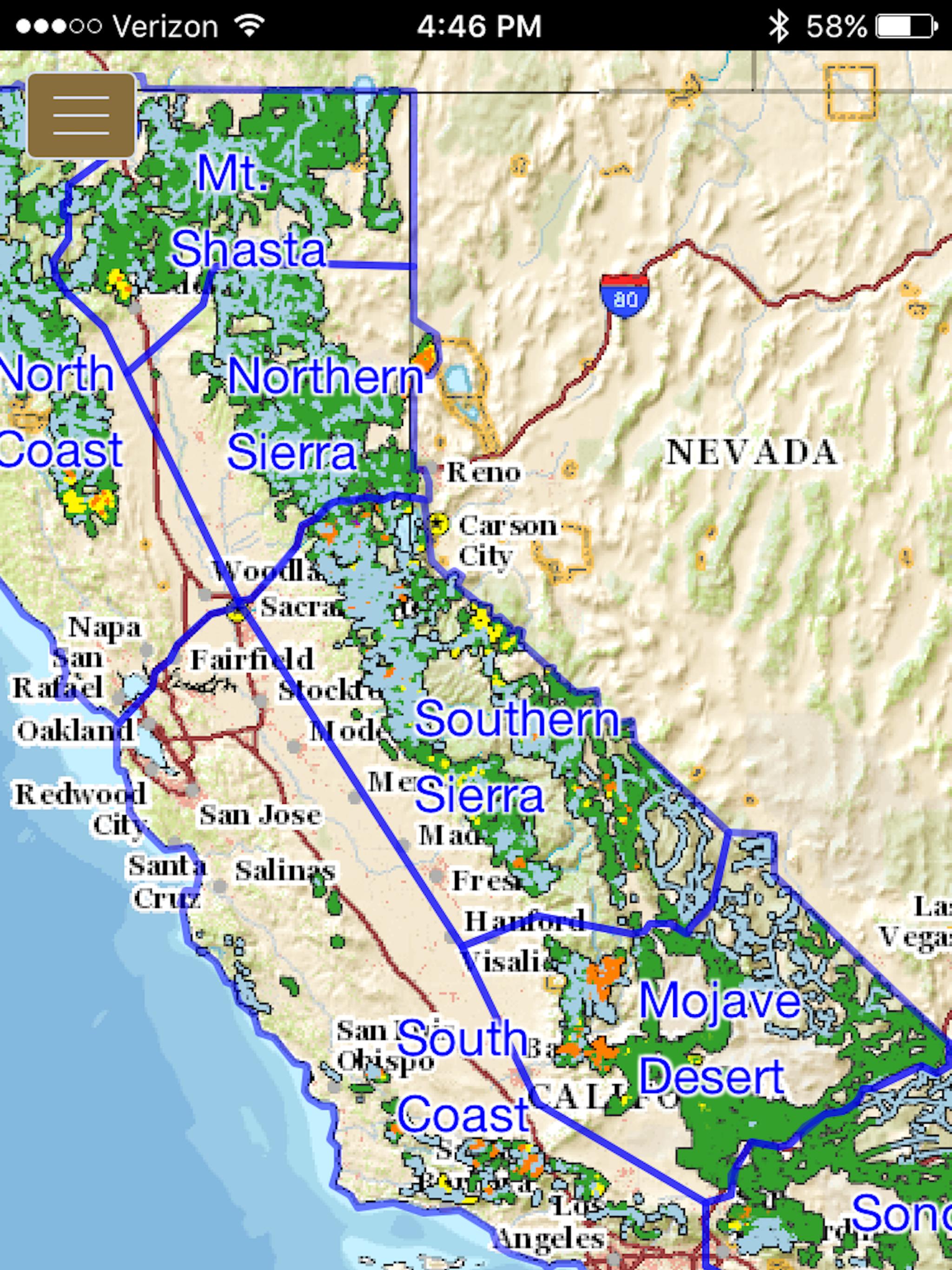
The OwlsheadGPS app includes more than 37,000 OHV and other motorized routes across lands managed by the Bureau of Land Management, US Forest Service, National Park Service, California Department of State Parks and Recreation, and other agencies throughout the State of California.
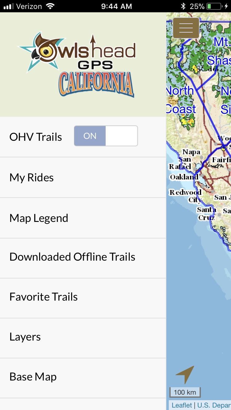
The OwlsheadGPS app allows you to:
√ Download trails and maps for any or all of seven regions to explore new and exciting areas outside the range of wifi and cell service,
√ Zoom and scroll across the map,
√ Display and update your location (iPhones and cellular iPads only),
√ View your location on the map whether moving or stationary,
√ Record and view saved tracks with My Rides,
√ Like and share with Favorite Trails,
√ Manage the display of data layers for wilderness, national monuments, military lands, park lands and other special status areas.
Please note that in order to use the OwlsheadGPS app offline, you will need to download large amounts of data. The first region that you download will contain data that pertains to all regions. Additional data sets will be smaller and take less time to download. The downloading of trail and map data for offline use is most successful across very fast internet connections, and when your device is awake and the OwlsheadGPS app is open. You will see a confirmation alert message when a data set has been successfully downloaded and is ready to use offline. If you do not receive this confirmation alert, please try your download again.
Location Services must be on to display and update your location on the map, or to record your tracks.
Last updated on 2018年09月15日
In this version we implemented new features, support for new devices and operating systems, updated route data, performance enhancements, and bug fixes. Specifically, significant improvements were made to location depiction, particularly while in motion, so the application will now update your location as you move. New features include "My Rides" which stores your saved tracks, and "Favorite Trails" with "Like" and "Share" components.


OwlsheadGPS Project
1.2.0 by Friends of Jawbone
2018年09月15日