




MGRS Navigation System hakkında
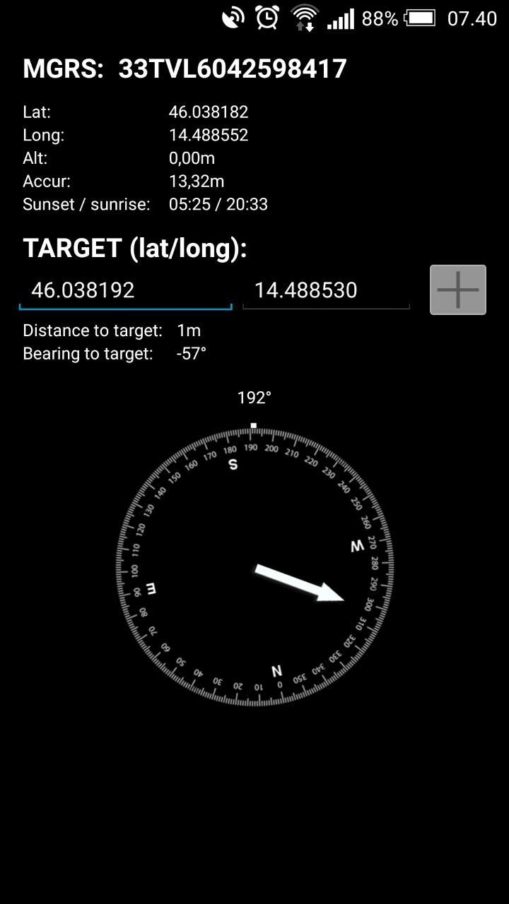
Navigation system with MGRS coordinates, compas and maps.
Navigation system with MGRS
follow progress on: https://www.facebook.com/MGRSNavigationSystem
- Basic compas tool
- Sunset / sunrise
- MGRS coordinate system
- Input target coordinates
- Get target location, bearing, distance
- Swipe from right to left for Map view, press back to go to compass view.
- Long press on map to add a marker
- Long press on marker to drag marker and change location
- Tap on marker to show location
- buttons to zoom to all markers
Work in progress:
- Google lat/long on target coordinates comming soon
- Tracking comming soon
Ek UYGULAMA Bilgileri
En Son Sürüm
1.12Yükleyen
Rezan Hawlery
Gereken Android sürümü
Android 4.1+
Kategori
Ücretsiz Araçlar UYGULAMAİçerik derecelendirmesi
Everyone
Bildir
Uygunsuz olarak işaretleEn son sürümde yeni olan 1.12
Last updated on Aug 7, 2015
New in version 16:
- bug fixes
- negative long/lat values fixed
- more to come!
NEW!
- added Lat/long (google) type of coordinate input (see screenshots) in dataview. Just tap on "Target" to change input.
- you can view MGRS or Lat/Long coordinates on target marker. Just tap on info bubble to change the system
- enabled map rotation and tilt
- sunset and sunrise data to data view
MGRS Navigation System Ekran görüntüleri



İlgili Etiketler
















MGRS Navigation System için bir inceleme bırakın
Yorum Ekle