Package Name:it.gecsoftware.tpad
SHA-256:973168222485469cafefd20f997a14dbe8c73059cd53f60eb659be504bae8793
Show More
Important:
- TPad needs a code to be activated;
- In the Demo version (without activation code) it will be possible to collect a maximum of 15 points and create a maximum of 2 booklets;
- For correct operation it is necessary to accept the required permissions;
- For information on use or purchase, you can call the number: 0825/1912258 or visit the website https://www.strumentitopografici.it/tpad/
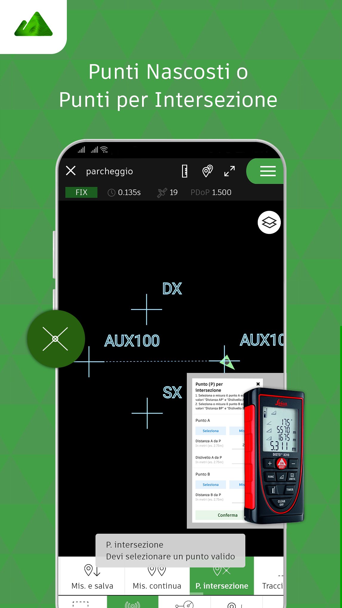
TPad is a topographic software to be used directly in the field thanks to any Android device of version 7 or higher.
A very simple guided procedure will allow you to connect, via Bluetooth or WiFi, the GNSS Emlid Reach RS2 and Emlid Reach RS + to your mobile phone or tablet and be immediately operational.
TPad is a simple and functional tool, capable of guaranteeing full control of the survey thanks to a real topographic CAD.
The management of the Layers, the Maps functionality, the connection to the WMS servers of the Cadastre, the roto-translation, the CoGo points and many other functions, make TPad the ideal software for all topographic activities to be carried out in the countryside.
Find out more on https://www.strumentitopografici.it/tpad/
Latest Version
3.23.02.01Uploaded by
Weerachai Sanbun
Requires Android
Android 7.0+
Category
Free Productivity AppContent Rating
Everyone
Security Report
Check Now
Report
Flag as inappropriateLast updated on Dec 6, 2024
- Ottimizzazioni sulla stabilità della connessione Bluetooth
- Ottimizzazioni e miglioramenti vari


APKPure - A multi-platform app store primarily focused on Android, providing extensive app-related content. Discover the app you want easier, faster, and safer, with quick and efficient downloads and installations.


