Use APKPure App
Get SafeAreaChecker2 old version APK for Android
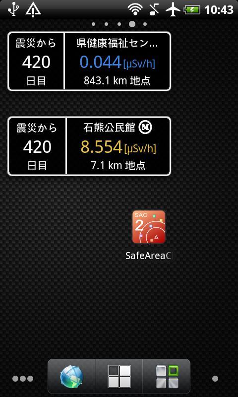
Display the distance from nuclear power plants Fukushima and the radiation.
The Tohoku region Pacific Ocean coast earthquake.
This time, I released the app to show current location on a map the distance from the nuclear power plant in Fukushima, Japan. In addition to on the map shows evacuation radius and the direction of the wind and radiation levels (Unit of radiation is "micro Sv/h") .
[Information]
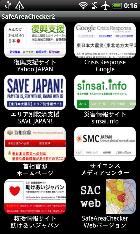
★Developer http://cactusapps.blogspot.com
★Facebook https://www.facebook.com/pages/CactusApps/279082165486955
Ver 4.2.0 : Add a function of Radiation graph.
Ver 4.1.0 : Speed up the map.
Ver 4.0.0 : Radiation corresponds to the site provides information of the Ministry of Education was revised in April 2012. Renewal application.
Ver 3.0.0 : Add a function to automatically update. Change the look of graph information.
Ver.2.12.0 : Add a function of Balloon-speed switching.
Ver.2.11.0 : Prepare an emergency evacuation of the area cleared (9/30).
Ver.2.10.0 : Change the graph of the map.
Ver.2.9.0 : Fukushima radiation data, change data in the The Ministry of Education.
Ver.2.8.0 : Add a new type of home screen widgets. To view any of the points.
Ver.2.7.0 : Home screen widgets support.
Ver.2.6.0 : Added a function of display information in a balloon when you tap a point.
Ver 2.5.0 : Add a function of display information in a graph of radiation in the past.
Ver 2.4.0 : Update planned evacuation zone. Change Information List of radiation. Add a satellite photo display mode.
Ver 2.3.0 : Add a function to share the current state.
Ver 2.2.0 : Add a function of the bar graph displays the radiation dose on the map.
Ver 2.1.0 : Add a function of view of planned evacuation zone.
Ver 2.0.0 : View point expanded all over the country.
Ver 1.5.0 : Add a function of the list of values of radiation.
Ver 1.4.0 : Add a function of view of predictions SPEEDI.
Ver 1.3.0 : Add a function of view of radiation.
Ver 1.2.0 : Add a function of view of wind direction.
Ver 1.1.0 : Add a function of view of distances from where you tapped.
Ver 1.0.0 : New Release.
[Notes]
Accuracy of the information displayed is not guaranteed. Please use only for reference.
[Operation]
Tap the bottom right button, move the screen. If you choose the settings menu, go to the screen configuration changes. Evacuation radius, and, GPS refresh rate (the refresh rate to update the distance) can be set.
Finally, I have respect for people working near nuclear power plants. And I pray for your safety.
[Keyword]
Geiger, Radiation, Radioactivity
[Thanks]
Charts rendered with aChartEngine!
Last updated on Jan 27, 2016
[4.2.3]Bug fix.
[4.2.2]Manual widget bug fixes.
[4.2.1]Change title icon.
[4.2.0]Add a function of Radiation graph.
[4.1.0]Speed up the map.
[4.0.0]Radiation corresponds to the site provides information of the Ministry of Education was revised in April 2012. Renewal application.
Latest Version
![]() 4.2.3
4.2.3
Uploaded by
Cristian Oliveira
Requires Android
Android 2.1+
Category
Report


Discover what you want easier, faster and safer.

SafeAreaChecker2
4.2.3 by Cactus Apps.
Jan 27, 2016