Use APKPure App
Get LPA Beach old version APK for Android
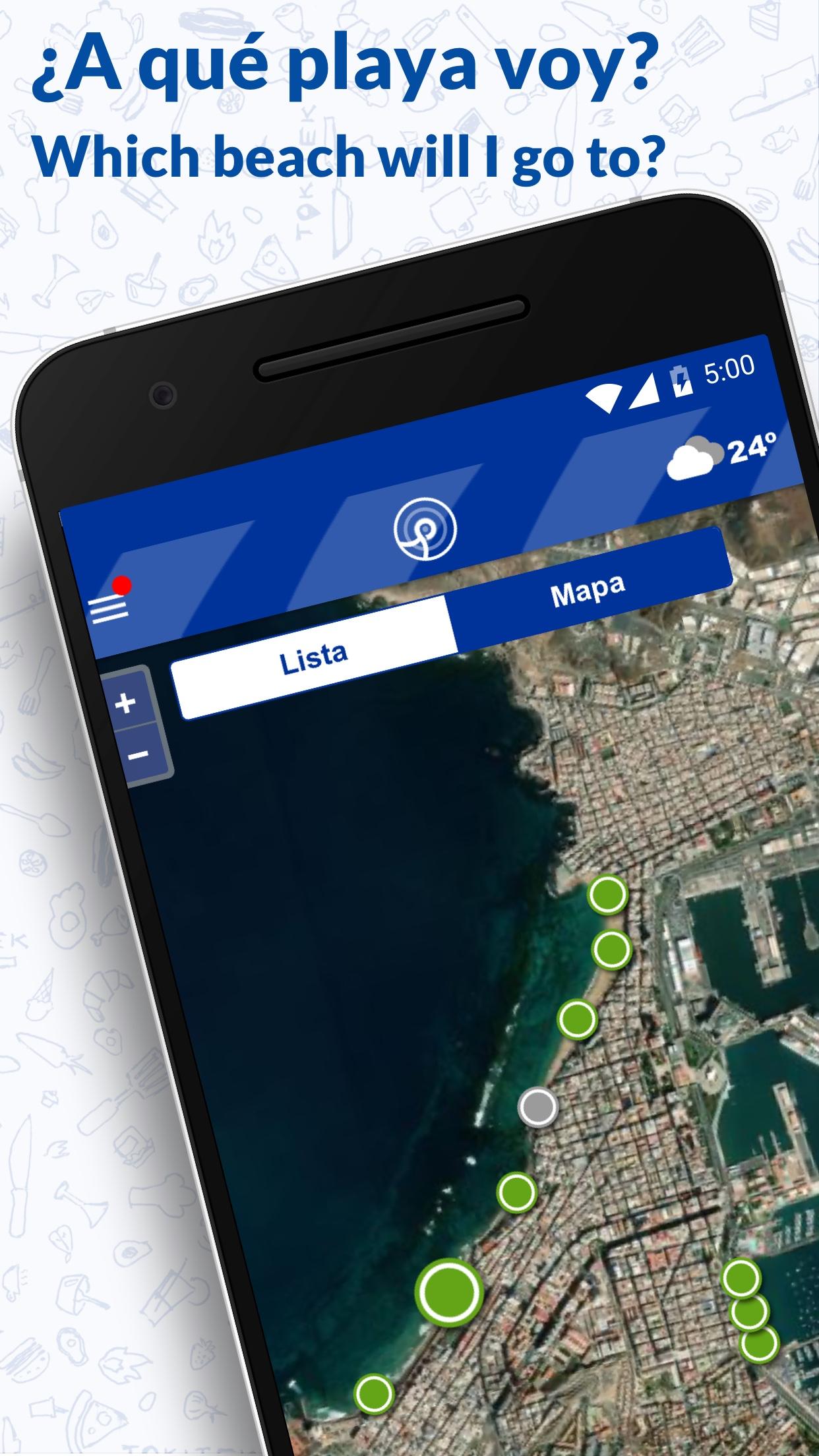
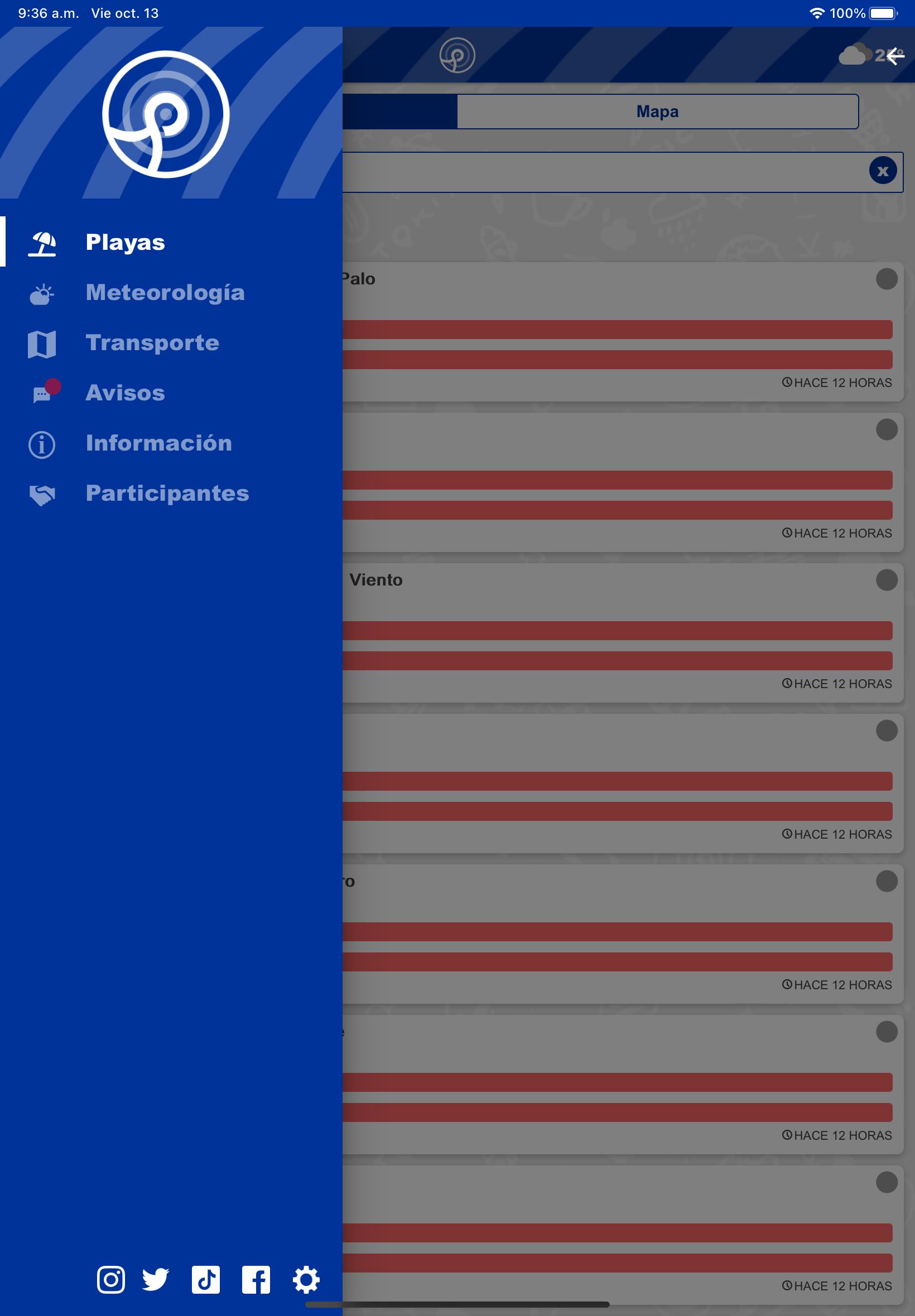
What beach you want to go?
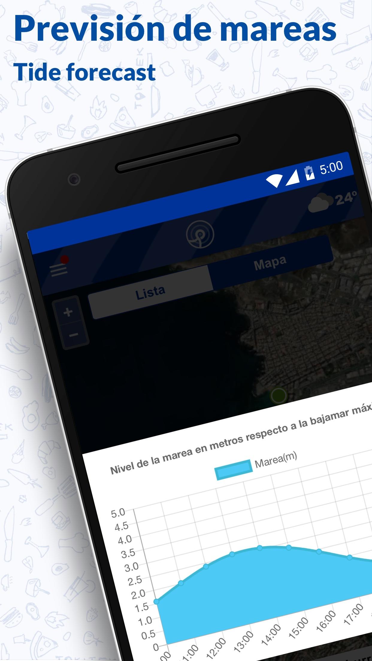
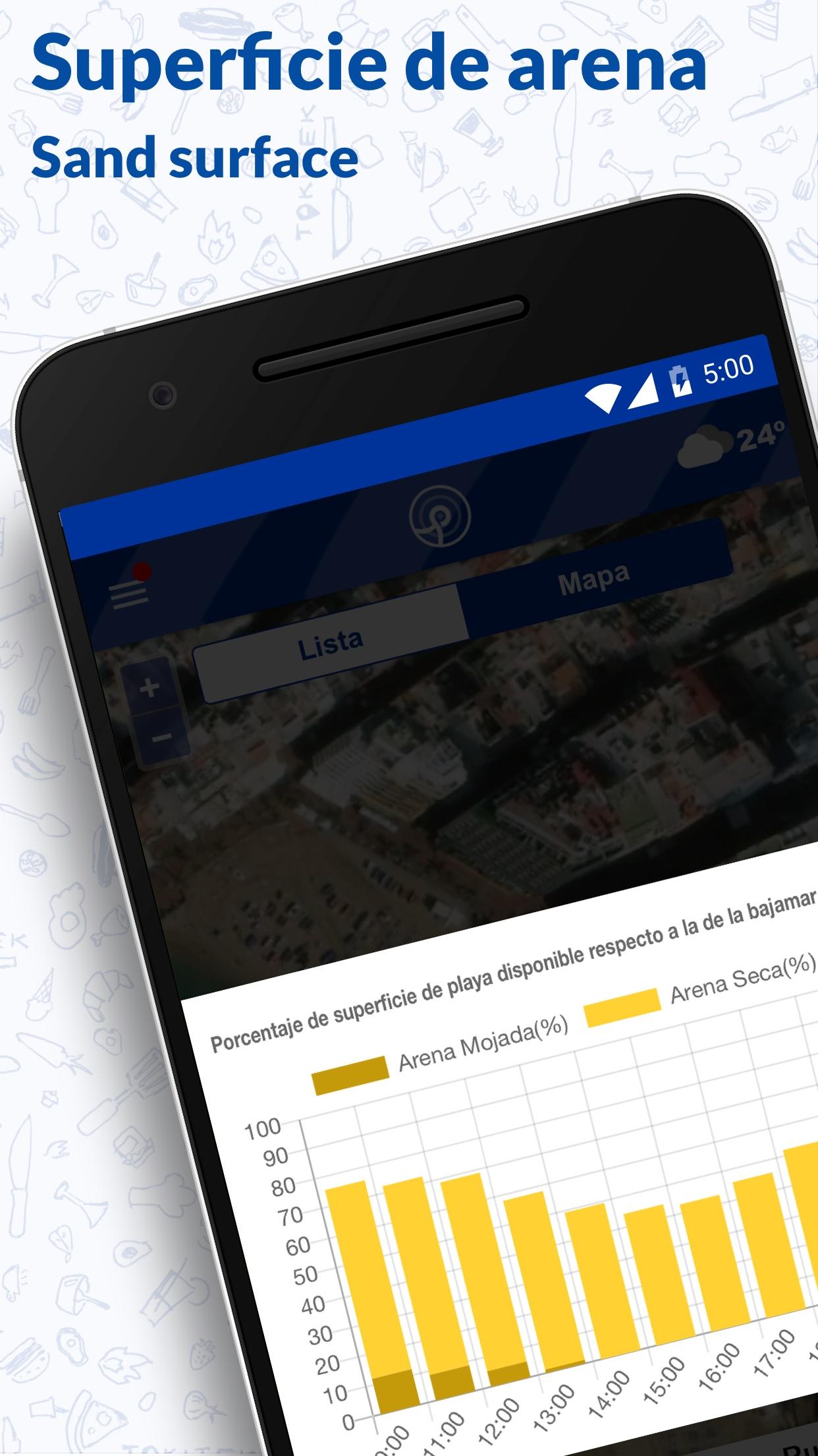
The sensorization of the three capital beaches will allow the captured data to be displayed interactively and dynamically, allowing the information to be quickly managed to adjust the response of the different services in charge of optimal maintenance of the coastline.
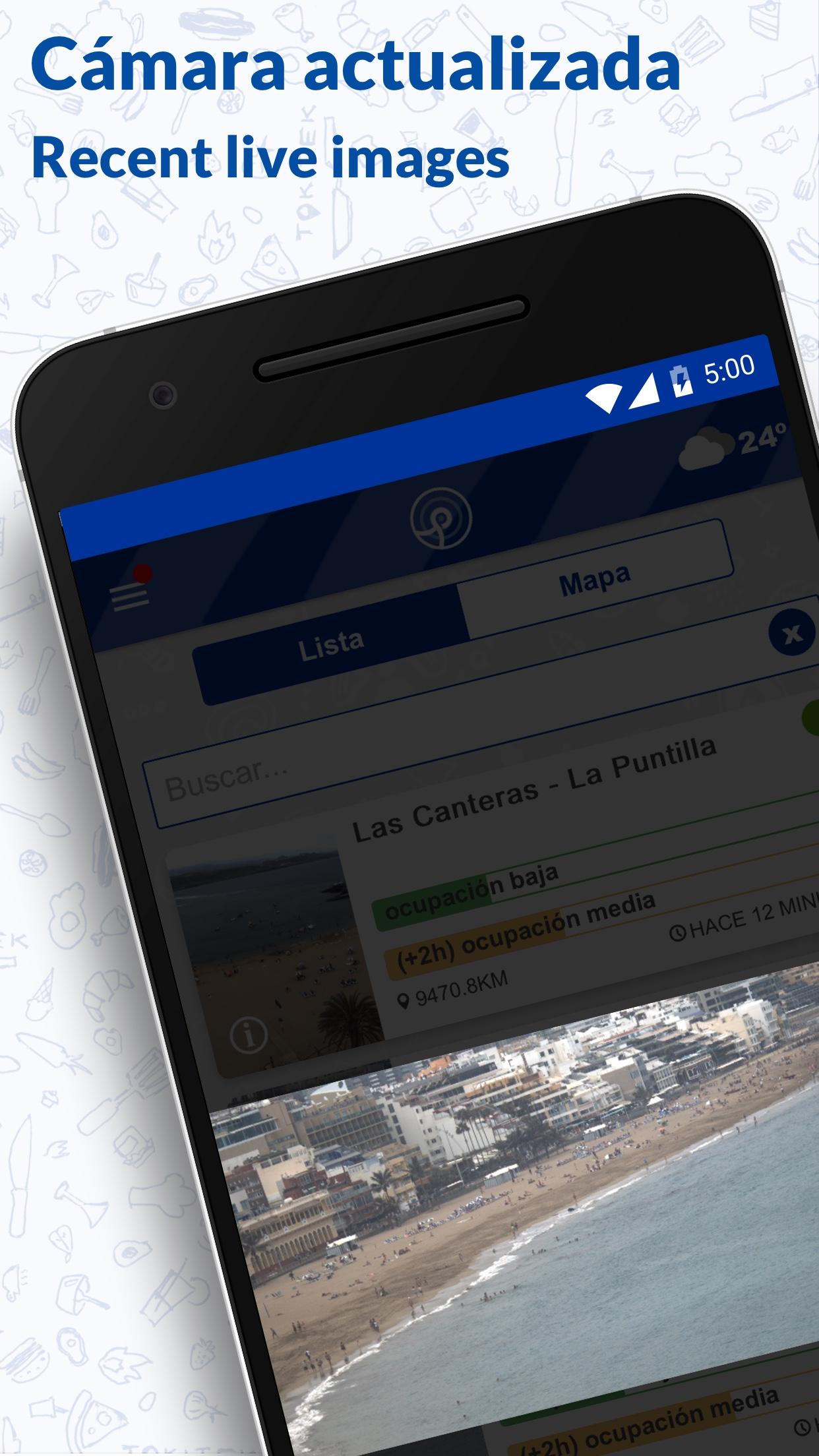
The departments of City of the Sea and Technological Innovation of the City Council of Las Palmas de Gran Canaria, through the Municipal Parking Society (Sagulpa), deploy a system to monitor the environmental state of the city's coastline through the deployment of a network of elements for capturing environmental information. The beaches of Las Canteras, Las Alcaravaneras and La Laja have the videometry system stations that will allow the intelligent management of these emblematic sandy areas of Las Palmas de Gran Canaria, the monitoring of the capacity of the beaches, their environmental status and safety in bathroom.
“As a City of the Sea, it is vital to be able to evaluate and treat the environmental, resource and economic impact of beaches and coastal areas thanks to the development of indicator systems that serve to support decision making, as well as to carry out efficient management of the infrastructure and public services offered therein.”
— City of Mar Department of the Las Palmas de Gran Canaria City Council —
The information provided in this tool is an effort to make the best available information available to citizens, in order to enjoy the beaches throughout the year in a responsible and safe manner. In any case, the occupancy ranges and capacity levels shown here are indicative and it will be the competent authorities who, based on these criteria and others they consider relevant, may open or close access to the beaches or give the appropriate recommendations in each case.
This action is part of the scope of the DATALAB project (MAC2/2.3d/323), co-financed by the Interreg MAC 2014-2020 Cooperation Program, which seeks to improve the capacity of municipal management towards intelligent use of data, addressing this technological challenge and taking advantage of digital information to consolidate Las Palmas de Gran Canaria as an innovative tourist space. It is also part of the Municipal Digital Agenda 2021-2025 (ADM) of Las Palmas de Gran Canaria, as project “P35. Beach and coastline management system”, in the line of action “L4.2. “Intelligent Beach and Coastal Management”.
The application uses GPS to organize the beaches closest to the user and suggest a route to access them. Continued use of GPS on your mobile phone may decrease battery life. The application makes use of GPS to order the beaches closest to the user and suggest a route to access them. Continued use of GPS on mobile may decrease battery life.
Last updated on Dec 1, 2023
Minor bug fixes and improvements. Install or update to the newest version to check it out!
Latest Version
![]()
Requires Android
Available on
![]()
Category
Report

Discover what you want easier, faster and safer.

LPA Beach
Ayuntamiento de Las Palmas de Gran Canaria
Dec 1, 2023