Use APKPure App
Get HikerBot old version APK for Android
All-in-one app for long trails. Crowd-sourced data, maps, planning, resupplies.
HikerBot is the ultimate all-in-one app for long-distance trails, created by former and current thru-hikers. Hikers, trail angels, volunteers, trail-side businesses, friends and family, future hikers, or arm-chair hikers and trail enthusiasts will all find something useful.
For Hikers:
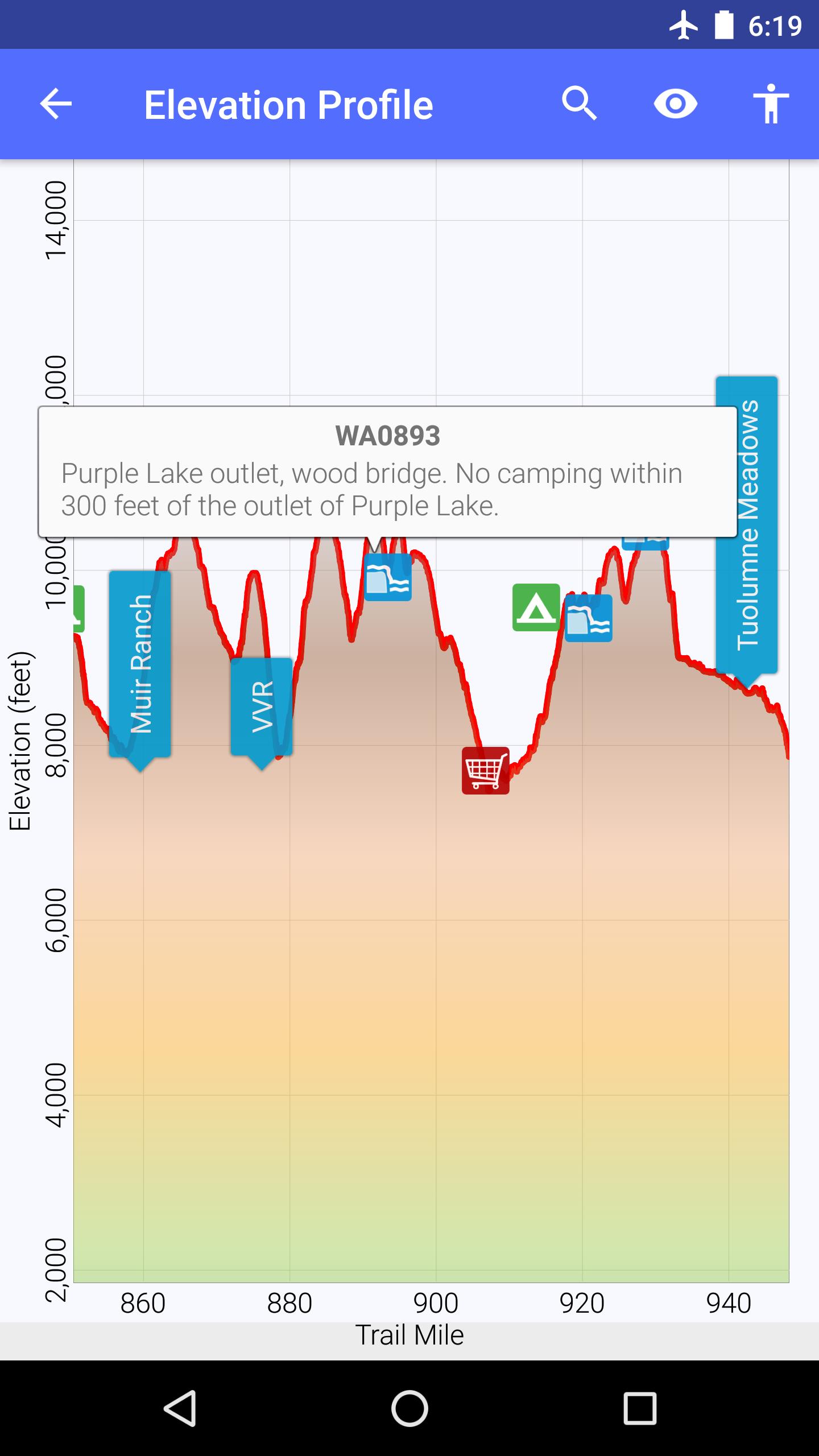
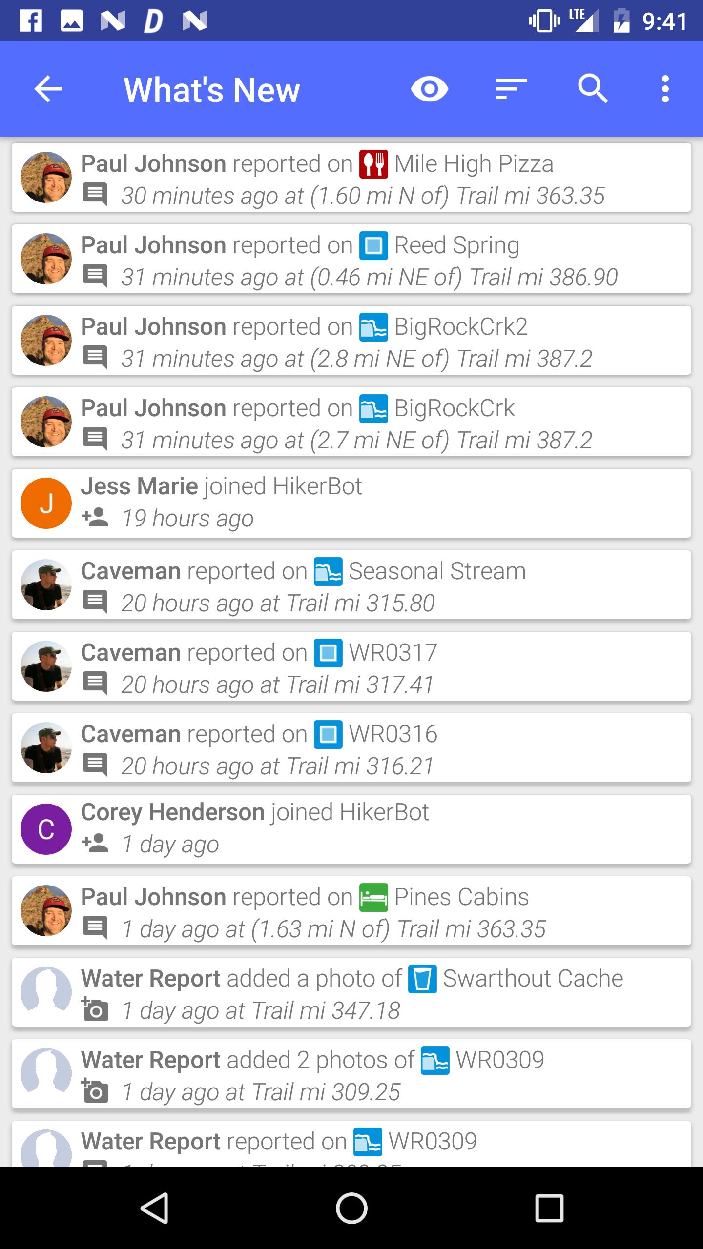
• Most up-to-date trail and town data crowdsourced by thousands of hikers. See water reports, snow conditions, stream crossing water levels, trail angel listings, bus schedules, restaurant and lodging reviews, and more.
• Any user can add waypoints, photos, comments, update descriptions, and edit any content in the app, in real time. Think Wikipedia! All data belongs to the community and is not copyrighted.
• Download topo maps, road maps, and satellite images for offline use.
• Navigate using GPS while in Airplane mode. Everything in the app works while offline, after the initial data download.
• View elevation profiles and compute distances to locations along the trail.
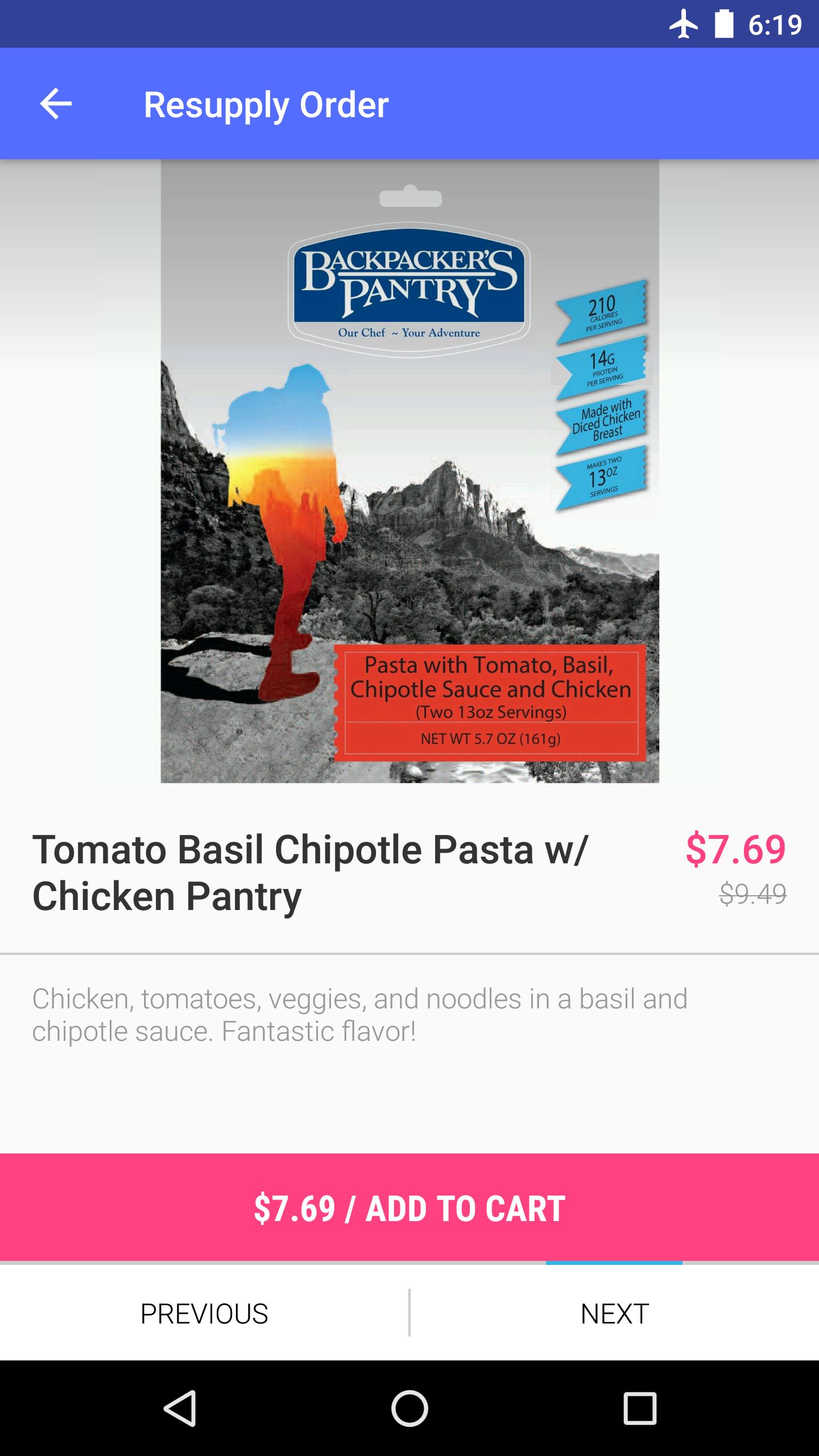
• Order a resupply box (food, gear, maps, and miscellaneous items) shipped to any location on the trail. Browse our store and queue up multiple resupply orders from your tent, even while offline! Checkout when you are ready.
• Share your location (optional) and see where others are on the trail.
• See a real-time feed of contributions other hikers are making.
• Search the map by name or point type, search the activity feed by hiker name, location, or type of edit.
For Trail-side Businesses:
• Create a free listing for your business with information you'd like hikers to know.
For Trail Angels:
• If you are interested in helping hikers you can list your contact information and what you can provide (transportation, accommodations, help for injured hikers, etc). Inform hikers of any specific rules and set expectations.
For Friends and Family:
• Track the location of your hiker on the trail.
• Send a gift card hikers can use in our store.
For Trail Maintenance Crews and Land Management Agencies:
• See real-time hikers reports of trail damage, blowdowns, and infrastructure maintenance needs (e.g., washed out bridges).
For Future Hikers and Trail Enthusiasts:
• Explore and learn about the trail. See current photos, use the wealth of information and hiker reports to plan your hike and resupply stops.
The following trails are included: Pacific Crest Trail (PCT), Appalachian Trail (AT), Continental Divide Trail (CDT), John Muir Trail (JMT), Sierra High Route (SHR), Wonderland Trail (WT), Great Divide Mountain Bike Route (GDMBR), Continental Divide Singletrack Trail (CDST), Hayduke Trail, Arizona Trail (AZT), Pacific Coast Trail.
Last updated on Jun 26, 2017
UI improvements and bugfixes.
Latest Version
![]() 0.82.29
0.82.29
Uploaded by
Yanguilherme Sales
Requires Android
Android 4.1+
Category
Report


Discover what you want easier, faster and safer.

HikerBot
0.82.29 by HikerBot
Jun 26, 2017