À propos de AISPilot
Diagramme nautique navigator - AIS appareils connexion (WiFi ou Bluetooth) .OpenSeaMap
AISPilot is a gps navigator with support for AIS (Automatic Identification System). It works with offline maps from OpenSeaMap project.
The application provides real-time AIS data , supporting different sources, WIFI and Bluetooth AIS devices, GPS Bluetooth and Built-in GPS.
Highlighted Features:
- Real time AIS data
- Offline maps based on Open Sea Map project.
- Download of OpenStreetMap maps of every country in the world
- Conection to AIS transponders.
- Vessels monitoring in Real Time.
- Customizing the displayed informatión.
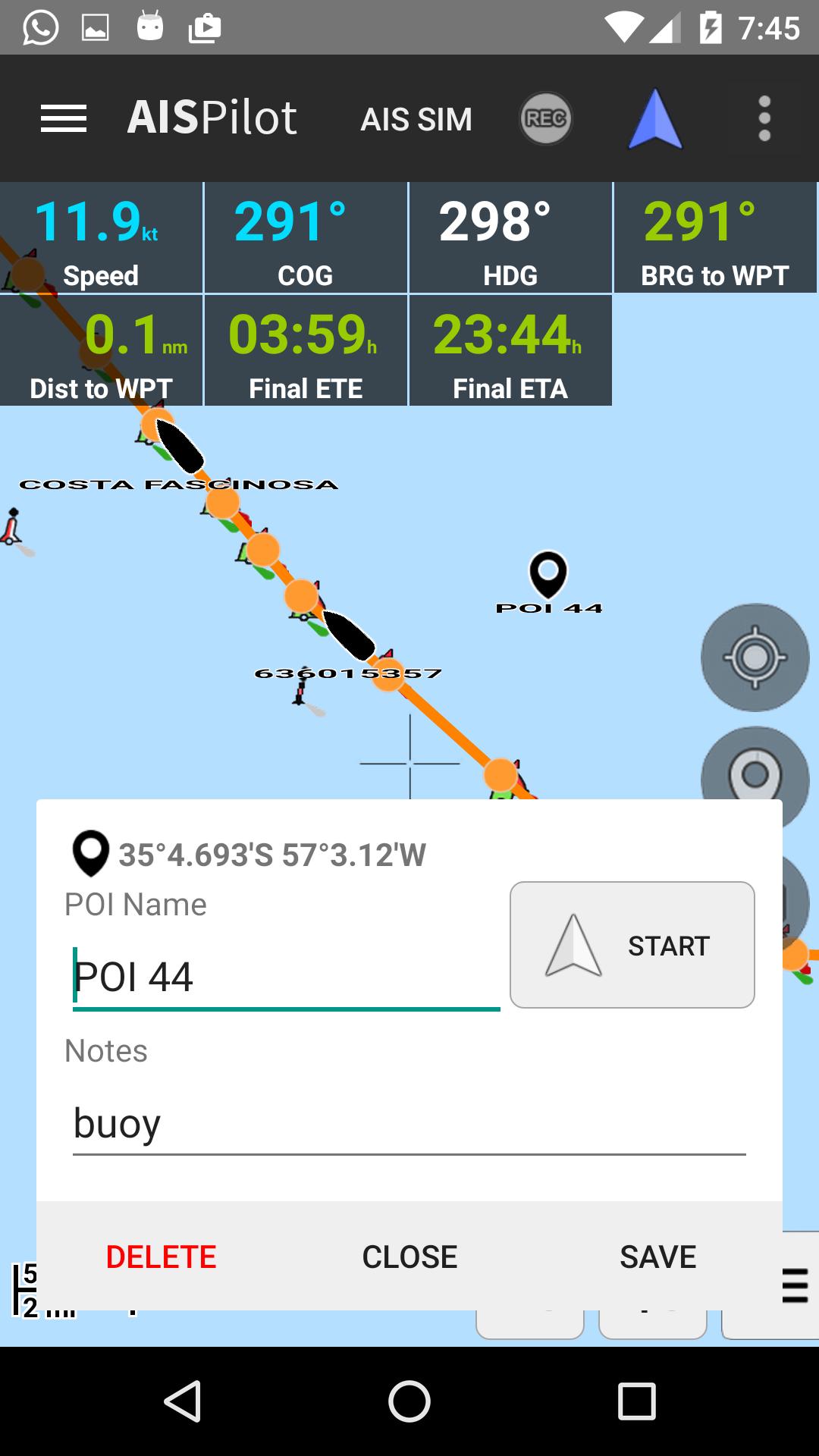
- Record of Tracks
- Record of Point of interests
- GPX Routes Navigation ascending or descending
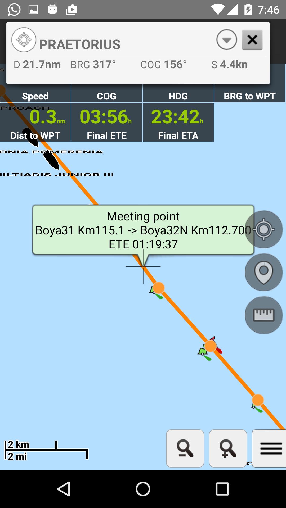
- Meeting and overtake points
- CPA and TCPA calculations
Informations Application supplémentaires
Dernière version
04_2019Telechargé par
Argent Abhi Otsuki
Nécessite Android
Android 4.0+
Catégories
Gratuit Outils APPLICATIONClassification du contenu
Everyone
Signaler
Signaler comme inappropriéQuoi de neuf dans la dernière version 04_2019
Last updated on May 1, 2019
Minor bugs fixed
AISPilot Captures d'écran


Vieilles versions de AISPilot
Toutes les versions
Balises associées
Articles populaires dans les dernières 24 heures
- Instructions pour télécharger la dernière version 19.23.33 de YouTube APK pour Android 2024
- Comment télécharger la dernière version de Google Play Store APK 42.0.20-23 [0] [PR] 654119317 pour Android 2024
- Comment télécharger Netflix APK dernière version 8.126.0 build 7 50767 pour Android 2024
- Comment télécharger la dernière version 13.3.0.42 de Snapchat APK pour Android 2024

![Comment télécharger la dernière version de Google Play Store APK 42.0.20-23 [0] [PR] 654119317 pour Android 2024](https://image.winudf.com/v2/image/YWRtaW5fR29vZ2xlLVBsYXktU3RvcmUtNi4xLjEyLUFQSy5wbmdfMTUxMzA2Nzg1ODQzOQ/banner.jpg?fakeurl=1&w=192)