Usar la aplicación APKPure
Obtener Singapore MRT Mapa Ruta versión histórica en Android
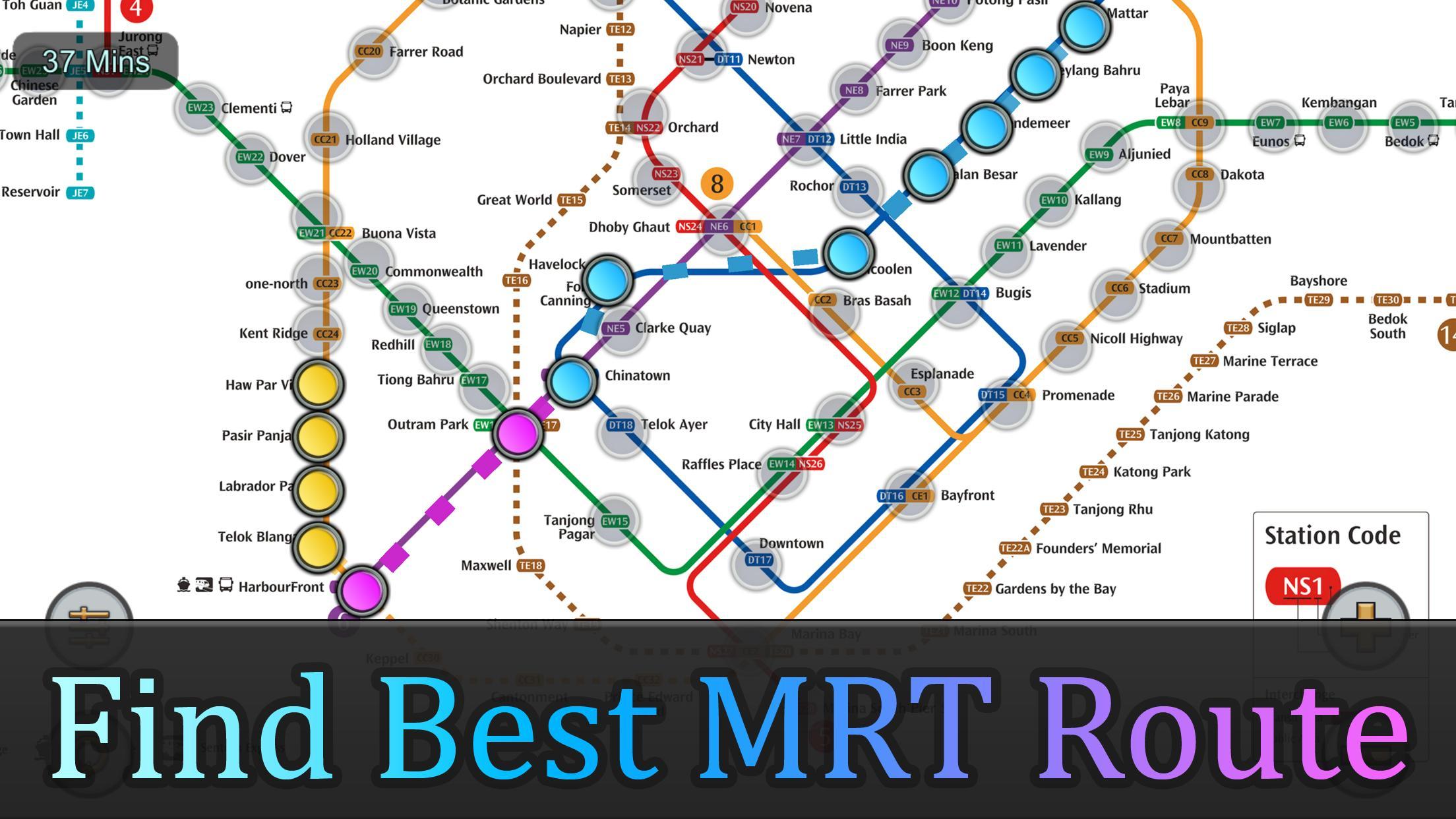
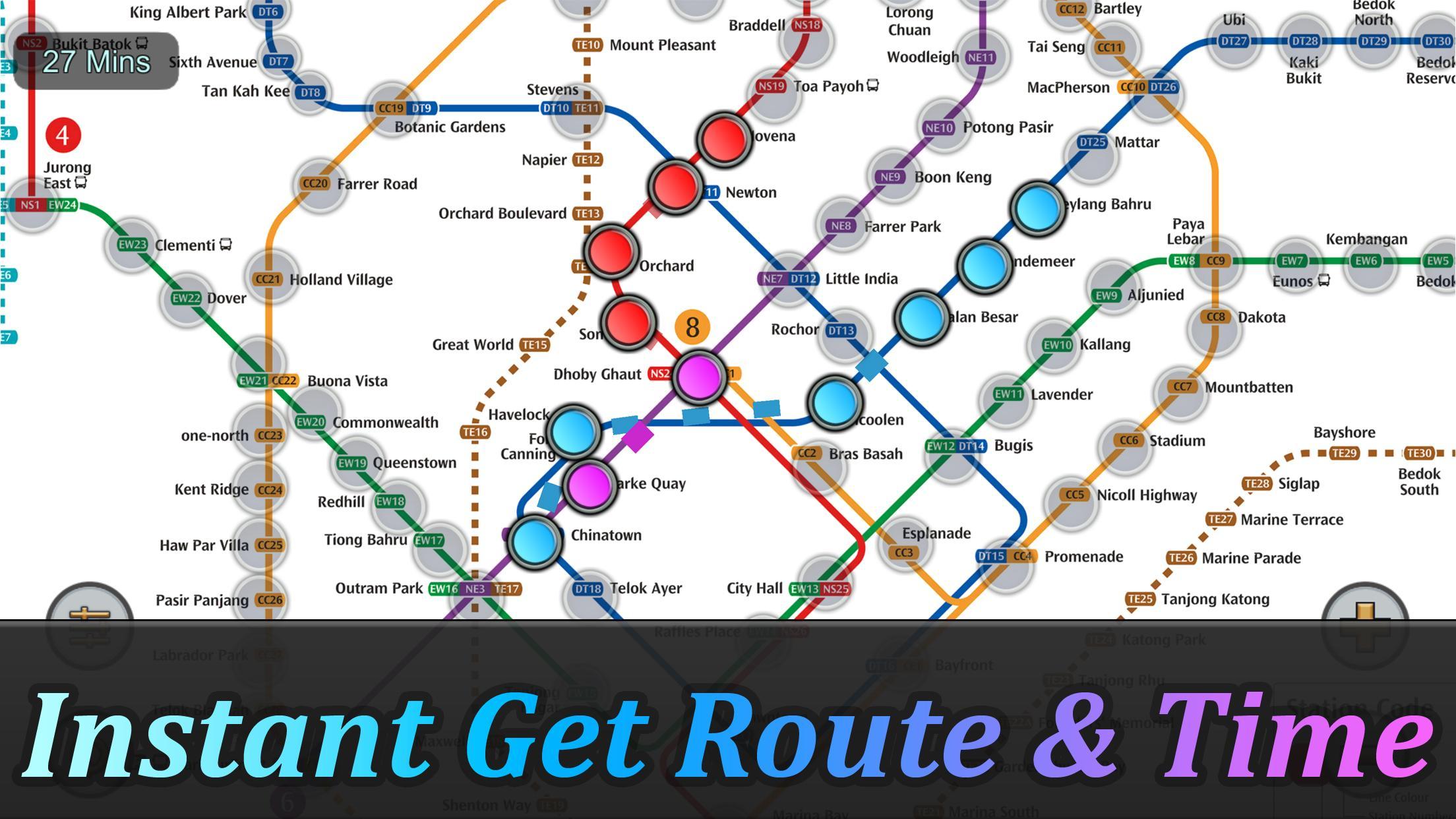
Obtener la ruta más rápida y el tiempo en un segundo.
El sistema de MRT de Singapur se está extendiendo. Para el año 2030, el sistema MRT será más complejo de lo que podría imaginar. Es bueno para todos los residentes de nuestra encantadora isla. Pero también será un problema porque no sabemos cómo viajar más rápido al trasladar estaciones.
Singapore MRT Map Route está diseñado para permitir al usuario obtener la mejor ruta dentro de un segundo. Le ayudará a ahorrar mucho tiempo durante años.
- Ver el mapa más grande de Singapur MRT
- Mostrar la mejor ruta entre dos estaciones
- Calcular automáticamente el tiempo de viaje estimado
- No requiere conexión a Internet.
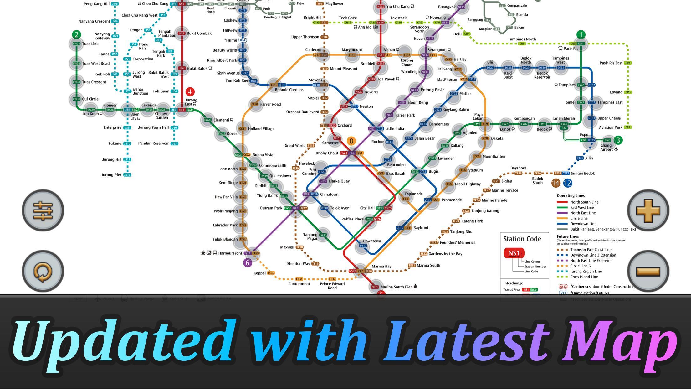
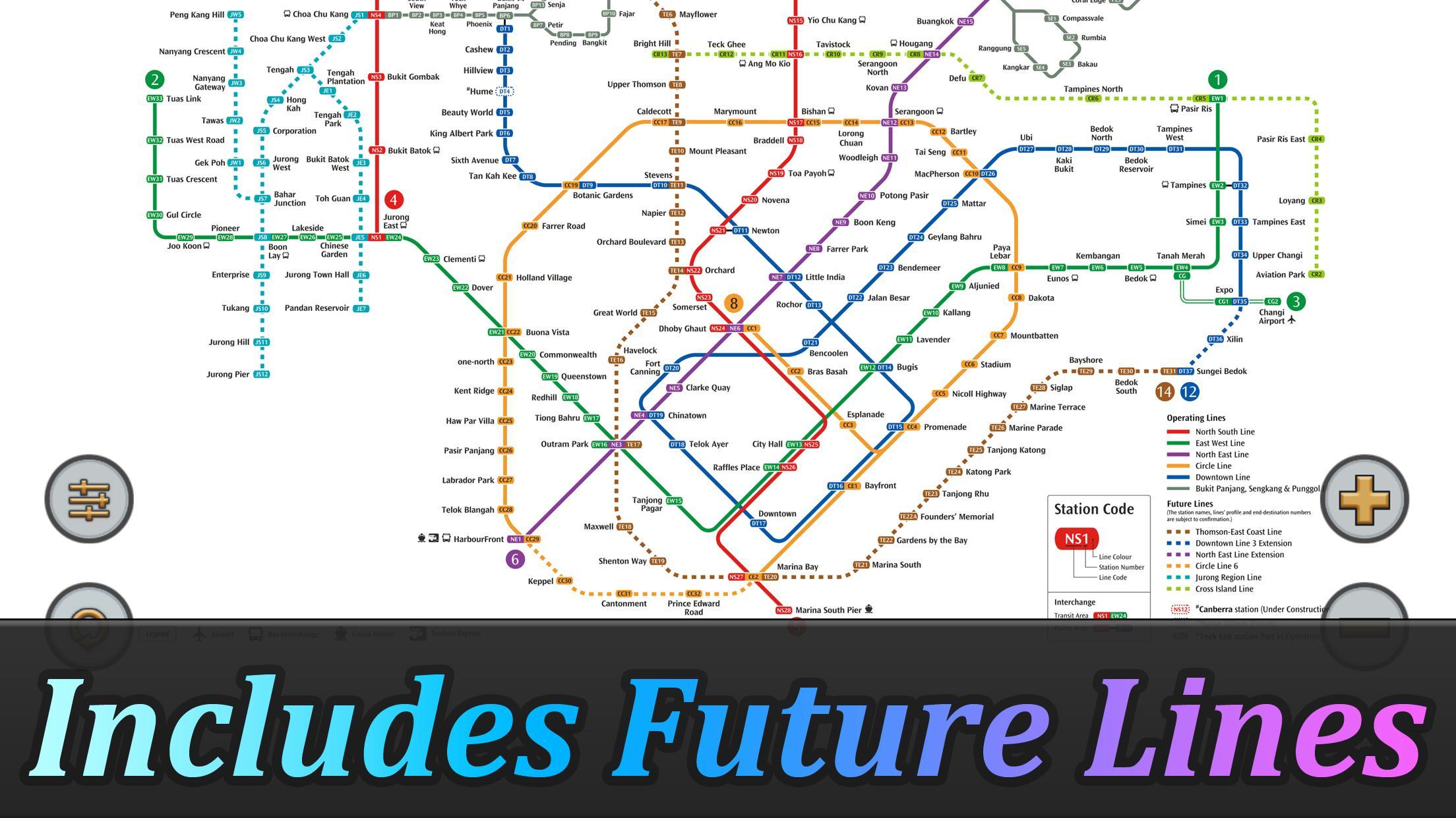
Actualizado al último sistema MRT:
Línea del centro (azul)
Bukit Panjang, Cashew, Hillview, Mundo de la Belleza, King Albert Park, Sexta Avenida, Tan Kah Kee, Jardines Botánicos, Stevens, Newton, Little India, Rochor, Bugis, Promenade, Bayfront, Downtown Telok Ayer, Chinatown
Línea Circle (Amarillo)
Dhoby Ghaut, Bras Basah, Esplanade, Promenade, Nicoll Highway [C], Estadio, Mountbatten, Dakota, Paya Lebar, MacPherson, Tai Seng, Bartley, Serangoon, Lorong Chuan, Bishan, Marymount, Caldecott, Botanic Gardens, Farrer Road, Holland Pueblo. Buona Vista, uno-norte, Kent Ridge, Haw Par Villa, Pasir Panjang, Parque Labrador, Telok Blangah, HarbourFront
Línea East West (verde)
Pasir Ris, Tampines, Simei, Tanah Merah, Bedok, Kembangan, Eunos, Paya Lebar, Aljunied, Kallang, Lavanda, Bugis, Ayuntamiento, Raffles Place, Tanjong Pagar, Outram Park, Tiong Bahru, Redhill, Queenstown, Commonwealth, Buona Vista , Dover, Clementi, Jurong Este, Jardín chino, Lakeside, Boon Lay, Pionero, Joo Koon, Expo,
Aeropuerto de Changi
Línea Norte Sur (Rojo)
Jurong Este, Bukit Batok, Bukit Gombak, Choa Chu Kang, Yew Tee, Kranji, Marsiling, Arbolado, Almirantazgo, Sembawang, Canberra, Yishun, Khatib, Yio Chu Kang, Ang Mo Kio, Bishan, Braddell, Toa Payoh, Novena, Newton , Huerta, Somerset, Dhoby Ghaut, Ayuntamiento, Raffles Place, Marina Bay, Puerto deportivo South Pier
Línea del este del norte (púrpura)
HarbourFront, Parque Outram, Chinatown, Clarke Quay, Dhoby Ghaut, Pequeña India, Parque Farrer, Boon Keng, Potong Pasir, Woodleigh, Serangoon, Kovan, Hougang, Buangkok, Sengkang, Punggol
Last updated on 10/07/2023
- Added Thomson-East Coast Line (TE1 Woodlands North to Orchard) to the subway system.
- Optimized calculation speed to improve the overall performance of the application.
- Fixed known issues and bugs to enhance the stability and reliability of the application.
Última Versión
![]() 2.4.5
2.4.5
Presentado por
Matas Klimisauskas
Requisitos
Android 5.1+
Available on
![]()
Categoría
Reportar


Discover what you want easier, faster and safer.

Singapore MRT Mapa Ruta
2.4.5 by momoStorm Entertainment
10/07/2023