下载 APKPure App
可在安卓获取GeoTrack的历史版本
记录你的GPS轨迹和轻松大地定位您的所有照片
Fan of travel and trekking, I designed this application to allow me to geotag all my photos. I record my trips with this application and then I export them in my other windows application PicaGeoTag (https://www.picageotag.com) to mark my photos with the GPS coordinates of the location of the shooting.
The operation is extremely simple thanks to the automatic calibration function between GeoTrack and PicaGeoTag.
Exports are in standard formats GPX, KML and KMZ. So you can use any software capable of processing these formats such as Google Earth.
GeoTrack is also interesting for trekking as it is the only one of its kind that records the number of footsteps at the same time. You can also record points of interest along the courses.
The application has been designed to be very battery-efficient so you can record even very long runs. Recording is done even when the screen is off or the application is closed.
If you use the application as a navigation tool, you can use it as a GPS (map centered and oriented on the heading of the device) keeping the screen on.
The main features are:
. GPS recording of trips and of number of foot steps.
. Recording of points of interest (waypoints).
. Recording while screen is off or application is closed (Saves battery)
. Choice between several maps: Google or Open Street Map Classical, Hiking Biking or Topographic.
. Real time location on map.
. Ability to keeps the map centered during displacements.
. GPS mode to orient the map following the heading of the device.
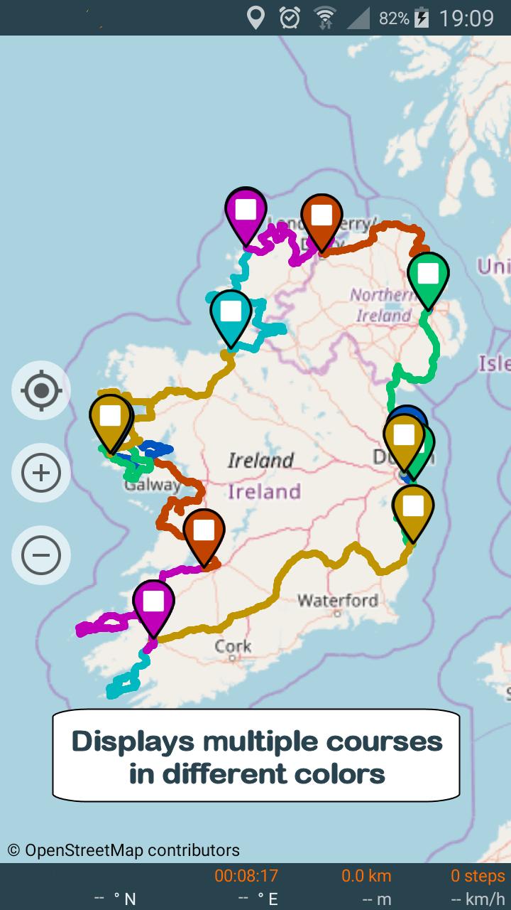
. Displaying selected trips on a map (one or more trips)
. Export / Share as GPX, KML or KMZ files (one or more trips per file).
. Import of GPX, KML or KMZ files.
. Calibration screen to adjust the time difference between the GPS track recorder and your camera.
. Statistics with graphs.
. Export / Sharing of charts
. Choice of measurement units (metric, english or marine units)
. Magnification up to 3 times of maps.
. Simplified offline mode (keeps the already loaded map elements indefinitely).
Remarks:
. Recording of the number of foot steps requires at least Android KITKAT and a compatible device.
. GPS mode requires a device with compass.
When importing files, prefer as much as possible GPX-type files that are faster to process.
Privacy:
This application respects your privacy. It uses the minimum possible permissions:
. 'Precise Position' to record GPS positions.
. 'Write / Read storage' (internal or SD card) to export the trips.
. 'Run at start-up' to resume a stopped recording after restarting the device.
Last updated on 2020年03月14日
Fixed bug regarding permissions on Android 10


GeoTrack
GPS tracker, viewer, Image geolocation5.2.5-G by Yves Cuillerdier
2020年03月15日