Use APKPure App
Get 서울 지하철 노선도 old version APK for Android
This is a smart subway app that provides information such as national subway route maps, subway timetables, real-time subway location and arrival information, and fastest route navigation.
■ All subway map images in Korea
We provide images so you can see the subways in the metropolitan area (Seoul), Busan, Daegu, Daejeon, and Gwangju at a glance.
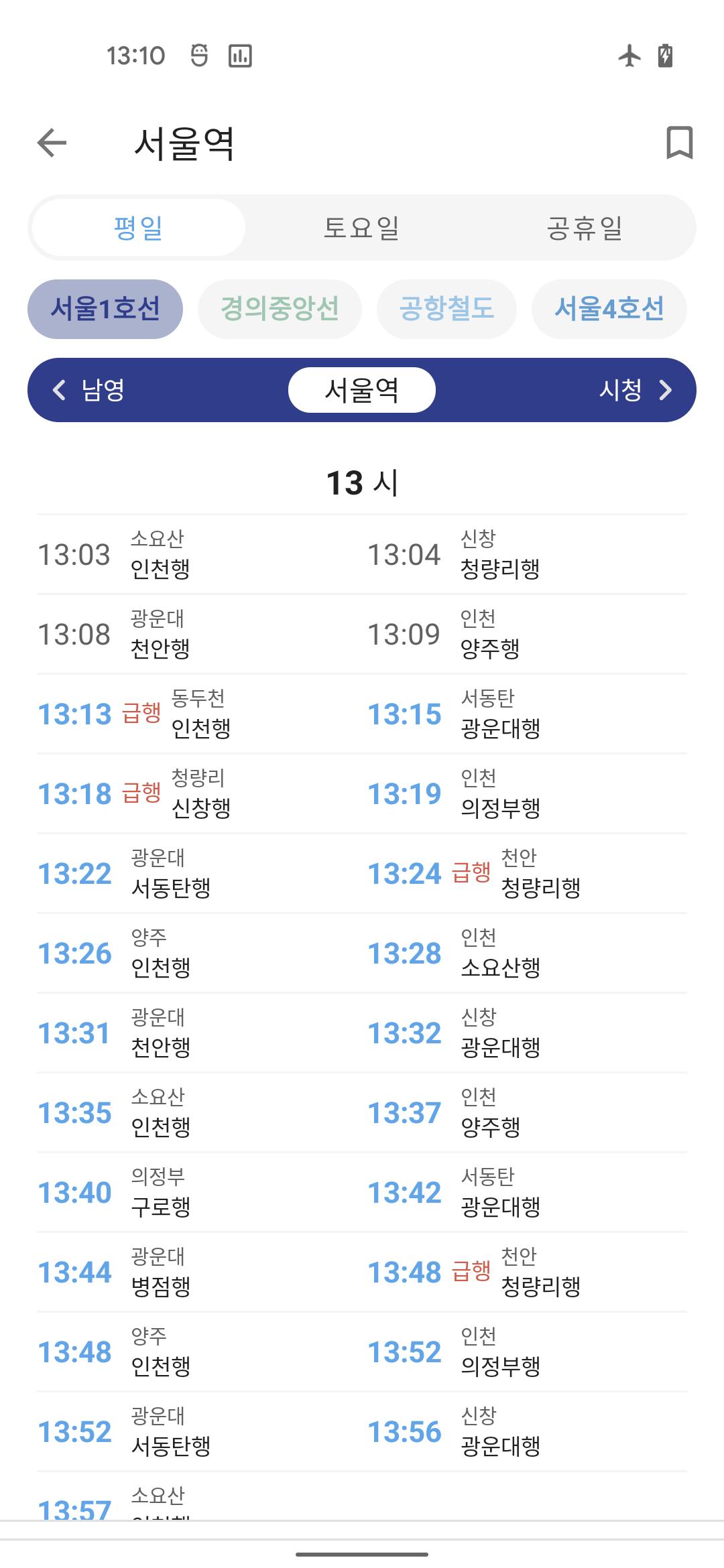
■ Subway timetable
You can easily view the subway station's timetable.
■ Route navigation
If you specify the departure station, transit station, and arrival station, the fastest route will be found.
■ Real-time subway location and arrival information
You can check the locations of all subways on the selected subway line.
You can also find out which subway will arrive at your station soon.
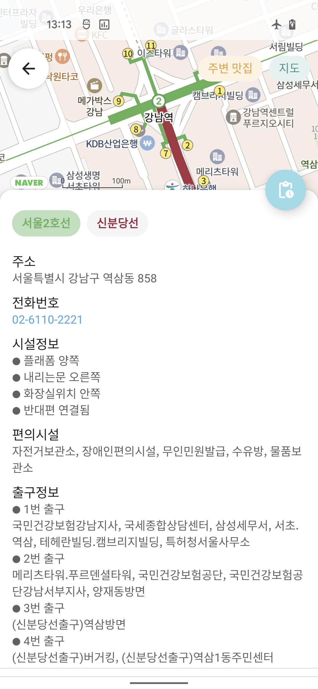
■ Detailed information of subway stations
It provides information such as subway station exit information, platform location, and restroom location.
■ Ttareungi information around the subway station
You can easily check information on Ttareungi around Seoul subway stations.
Last updated on Apr 6, 2024
GTX-A 노선 추가
Latest Version
![]() 6.0.47
6.0.47
Uploaded by
علي دغريري
Requires Android
Android 5.0+
Available on
![]()
Category
Report


Discover what you want easier, faster and safer.
")
서울 지하철 노선도
6.0.47 by Shining
Apr 6, 2024