Use APKPure App
Get Stadtatlas München old version APK for Android
Historical maps of Munichover 50 historical geo. Maps of Munich
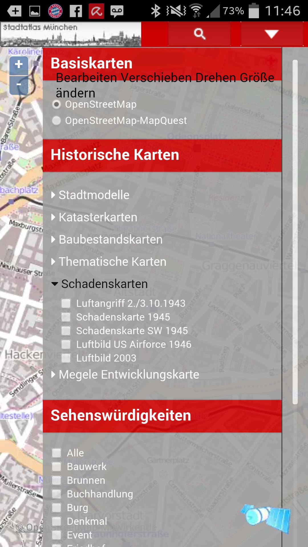
Historische Karten von München
Diese App zeigt alle verfügbaren Karten von München zurück bis ins Jahr 1158.
alte Stadtmodelle
Katasterkarten und Uraufnahmen,
Katastrophenkarten und Luftangriffe,
Stadtentwicklungskarten,
Luft- und Satellitenaufnahmen verschiedener Epochen
Baulinien
Stadtbäche
Interessante Gebäude, Sehenswürdigkeiten, alte Luftaufnahmen.
Alle Karten sind georeferenziert und erlauben das Auffinden mit GPS Koordinaten. GPS in mobilen Endgeräten werden unterstützt und führen die Karten nach.
Last updated on Sep 9, 2016
Minor bug fixes and improvements. Install or update to the newest version to check it out!
Latest Version
![]() 1.0
1.0
Uploaded by
مصطفى محسن
Requires Android
Android 2.3.4+
Category
Report


Discover what you want easier, faster and safer.

Stadtatlas München
1.0 by CADdy mapservices
Sep 9, 2016